April 28: Northwest Texas Thunderstorm
Developing storm. However, thick high-level clouds are reducing instability and spoiling any chance for daytime supercells in my target area (southwest Oklahoma and northwest Texas). This cell soon weakens.
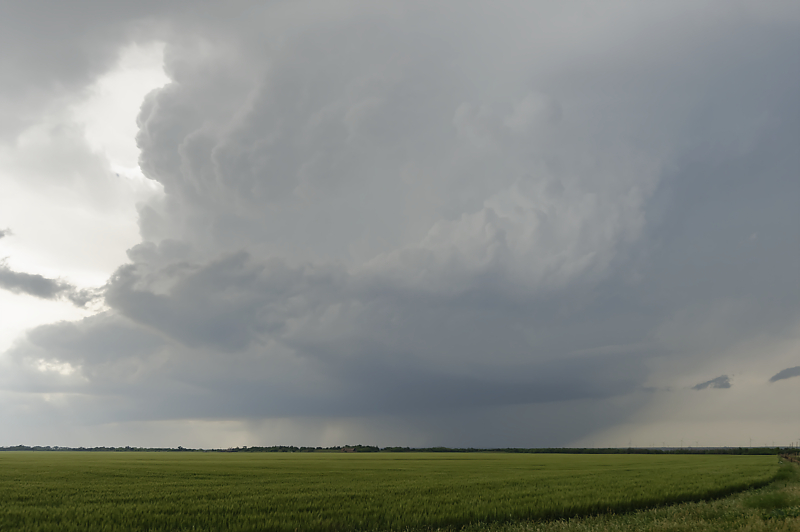
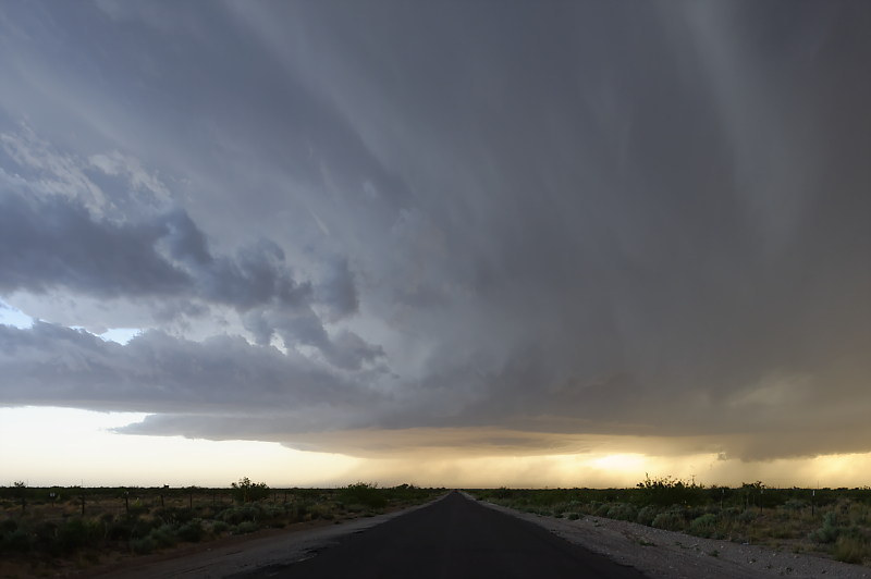
I intercept a low-visibility MCS as it races north, then happen upon this scenic LP storm behind it, near the ghost town of Medicine Mound.
That is one of the Medicine Mounds on the left, located west of Vernon, Texas.
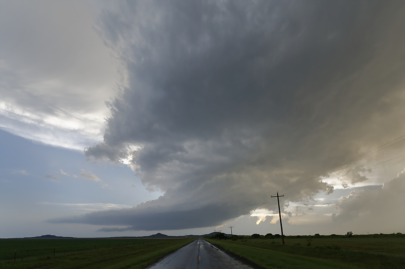
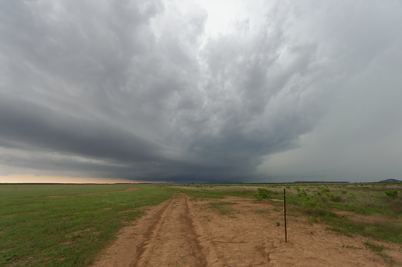
Strong rotation, but post-MCS instability is limited.
I only see one other storm chase vehicle on this remote Texas highway.
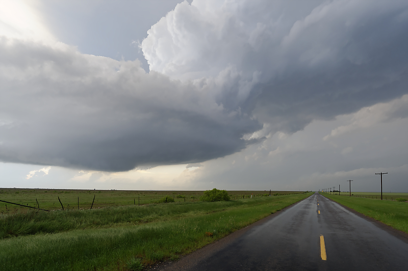
April 29: Northwest Texas Supercell
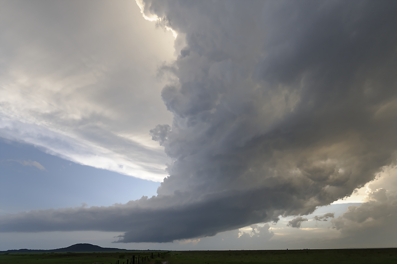
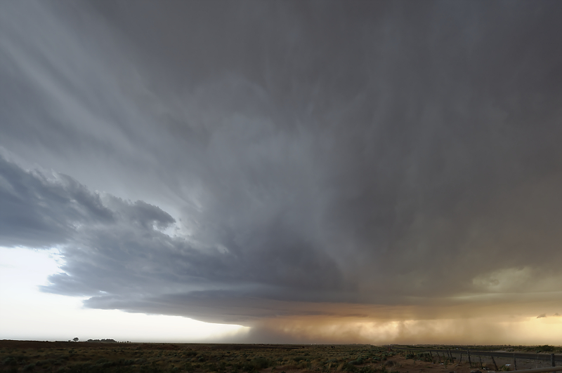
Beautiful supercell west of Benjamin, Texas.
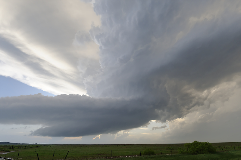
HP Supercell with very large hail. I stay well ahead of the storm due to a large crowd of chasers and locals.
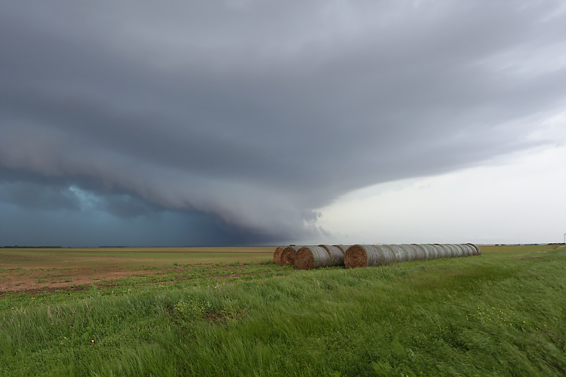
I manage one other scenic view ahead of the storm.
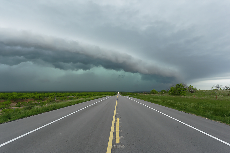
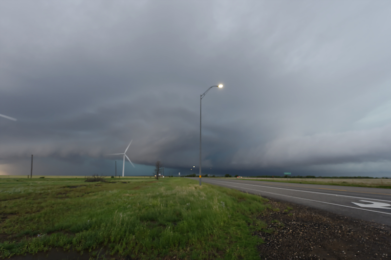
Shelf cloud along the southern flank of the storm. I bailed south in Seymour to avoid getting caught in heavy chaser traffic ahead of an HP Supercell.
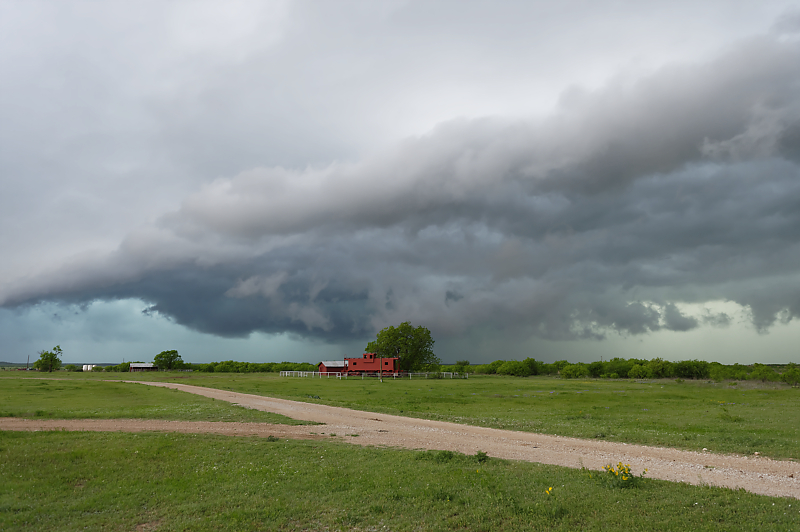
Cattle ranch with a red train caboose. Nice storm views today, but with overcrowded roads ahead of a potentially dangerous HP Supercell. With dark conditions and the need for a tripod, it was very difficult to safely position for good storm photos. I have no interest in getting caught in a slow-moving line of storm chase vehicles in the path of a fast-moving storm!
May 1: Texas Panhandle Squall Line
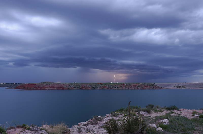
Weak squall line visible from my campsite by Lake Meredith, north of Amarillo.
May 4: Southwest Texas Supercell
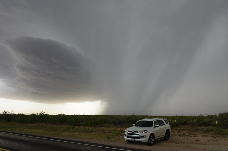
High-based thunderstorm near Monahans, Texas.
The first storm weakens, so I head north for an intercept near sunset.
Beautiful high-based storm near Kermit, Texas.