April 22: West Texas Storm
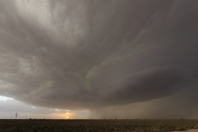
First scenic thunderstorm of my 2025 storm chase season is near the town of Seagraves in west Texas.
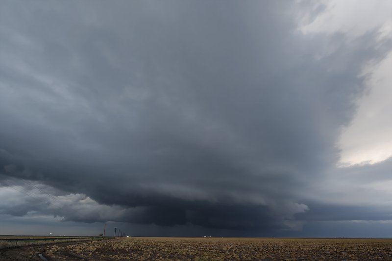
April 23: Northern Texas Panhandle Storm
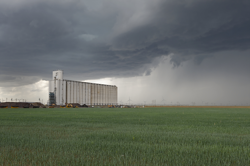
Marginally severe storm over wheat country in the northern Texas Panhandle.
April 24: More Texas Panhandle Storms
Strong updraft as a thunderstorm develops near Stinnett, Texas. Golfball-size hail is falling from this tower.
I follow the storm north, then east until road options become limited.
Storm becomes intense at dusk as wind fields strengthen.
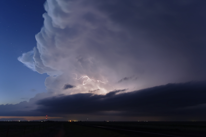
Further west, after dark, I catch this newly formed thunderstorm.
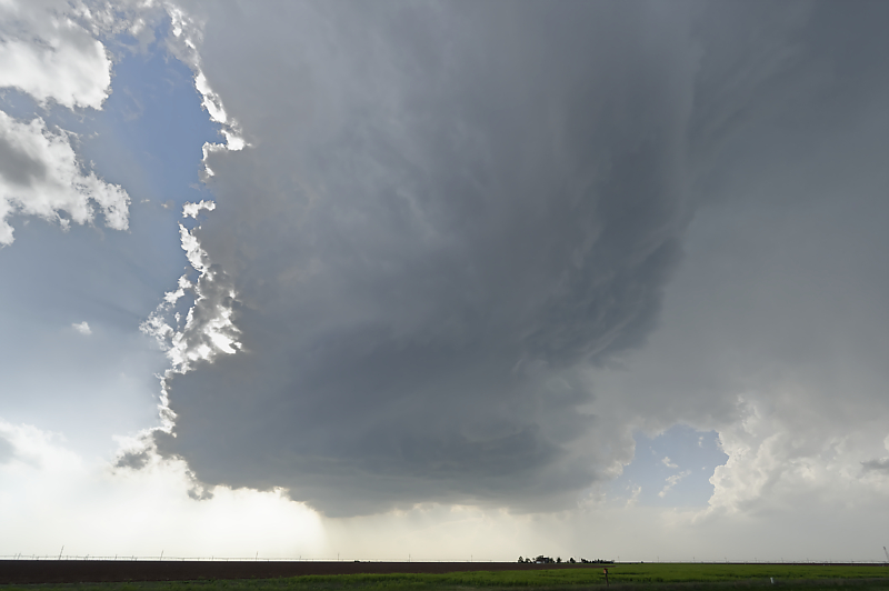
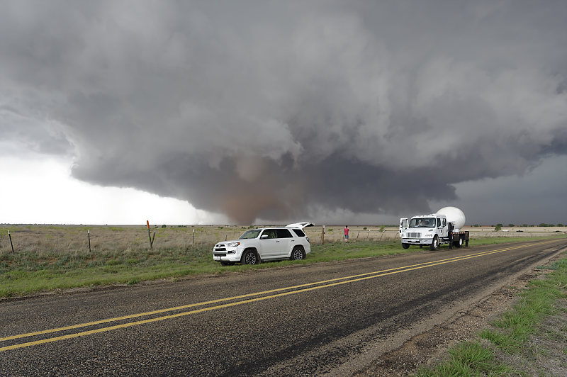
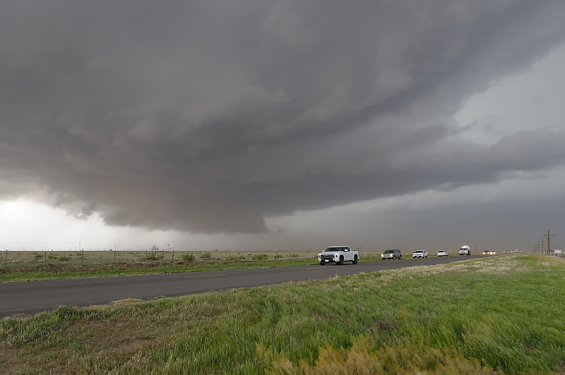
April 25: West Texas Tornado
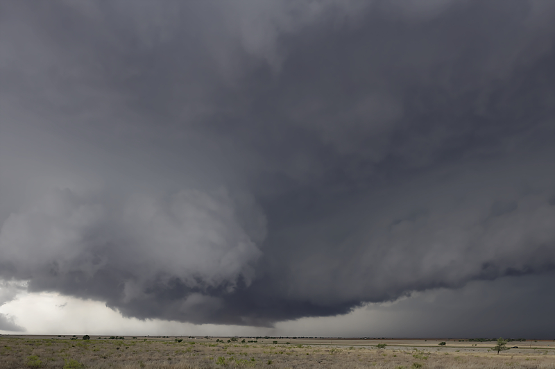
Target today is along a west Texas dryline.
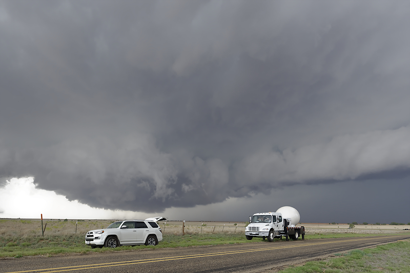
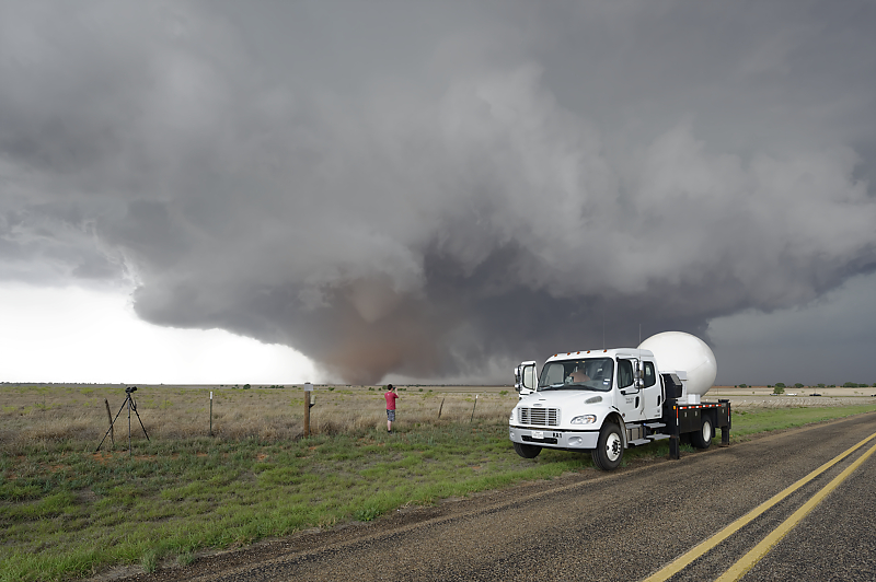
After I find a good viewpoint, a storm research radar truck pulls up behind me.
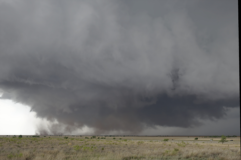
Rapid rotation of low-hanging wall cloud is stirring up dust.
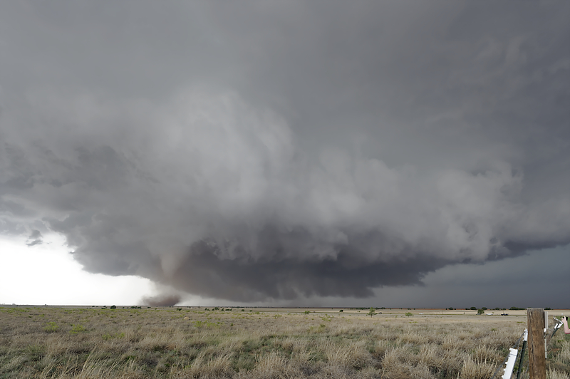
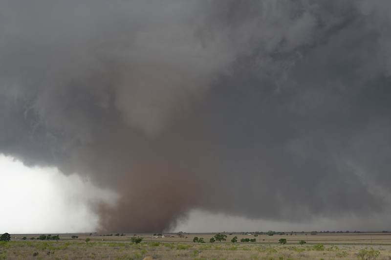
Funnel cloud with a dirt whirl underneath, a sure sign of tornadic circulation from cloud to ground.
Zoomed-in view of weak tornado. This storm formed at the intersection of the dryline and an outflow boundary from earlier convection.
Wide-angle view of storm updraft.
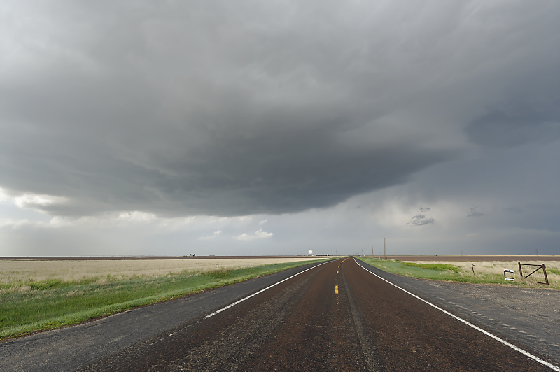
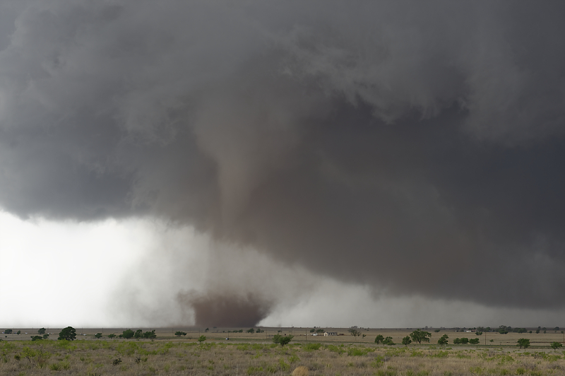
Spectacular scene southeast of Muleshoe, Texas.
Freshly plowed field produces large dirt plume.
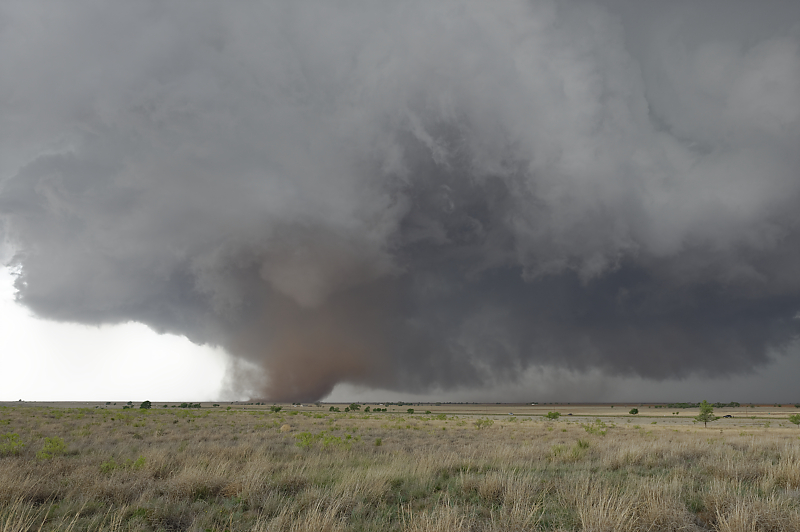
Another view.
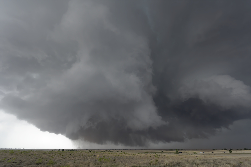
The wall cloud is even more impressive after the tornado dissipates. But cool air has now undercut the updraft, leading to a loss of low-level convergence.
The supercell continues as an impressive hailstorm.