April 3: Texas/Oklahoma Supercell
Not much moisture today, but good wind shear should result in one or two picturesque storms in the Texas Panhandle.
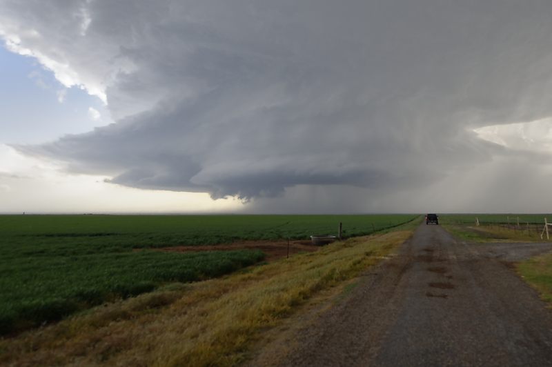
Strong updraft at the southern end of a multi-cell thunderstorm complex.
Storm slowly strengthens as it nears the Oklahoma state line.
Picturesque storm in the southeastern part of the Texas Panhandle.
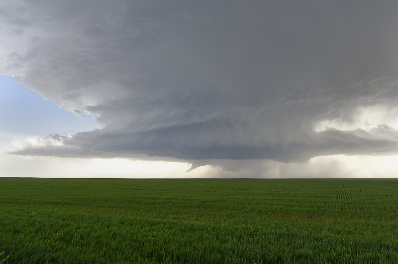
Mid-level winds begin to strengthen late in the afternoon, causing the storm to intensify.
Now in Oklahoma, near the town of Hollis.
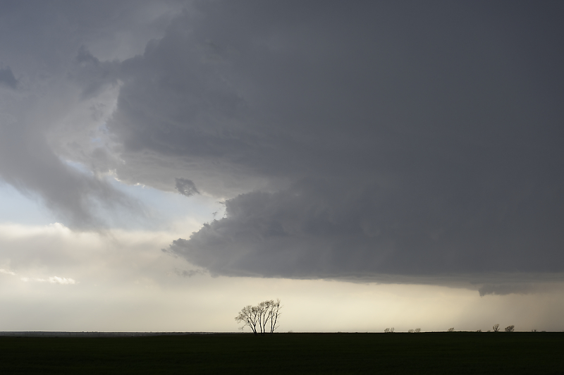
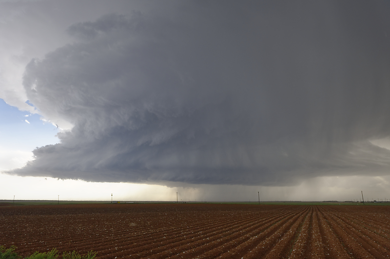
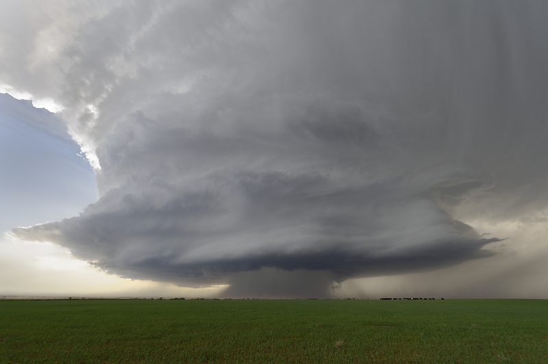
LP Supercell over a freshly ploughed field in the rich farmland of far southwestern Oklahoma.
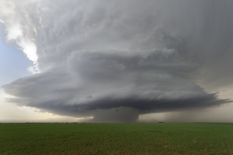
The storm has a beautiful sculpted appearance.
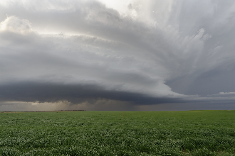
Wide-angle shot of the supercell from two miles south of Gould, Oklahoma.
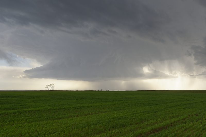
Storm over a newly planted wheat field.
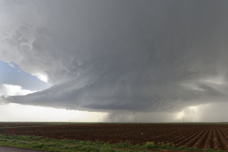
Scenic Southern Plains supercell to start the storm season.
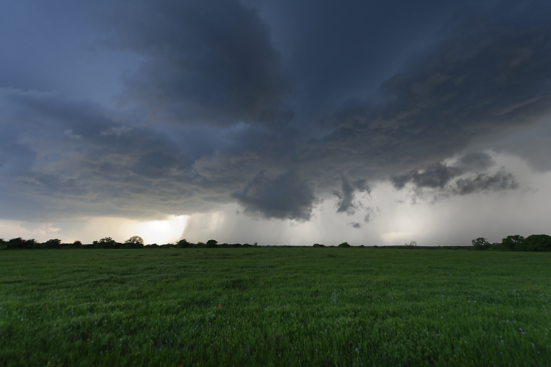
View of the storm as it slowly weakens.
Near Eldorado, Oklahoma as sunset nears.
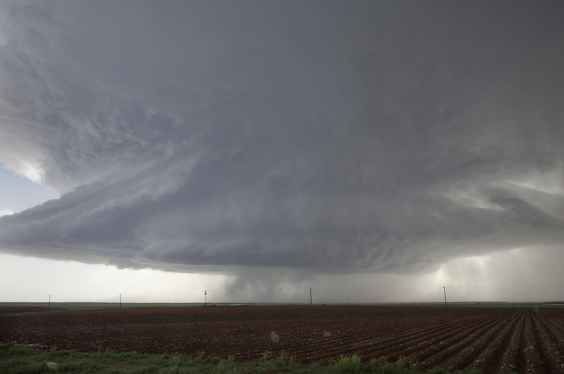
Last look at the storm.
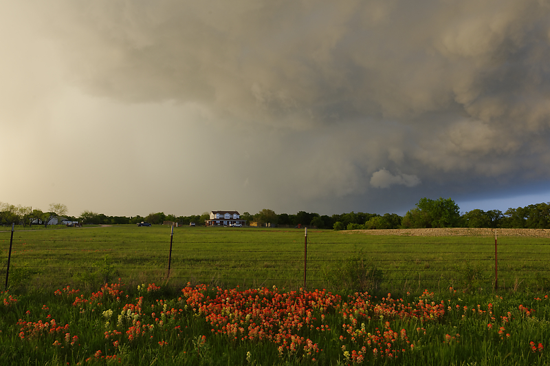
April 17: North Texas Storm
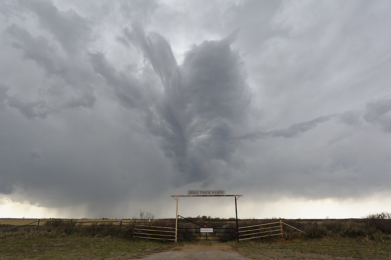
Evening storm in north central Texas.
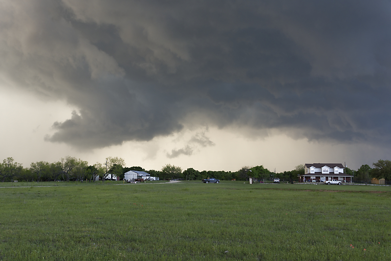
North Texas ranch as a severe storm passes just to the north.
Rear of the storm at sunset.
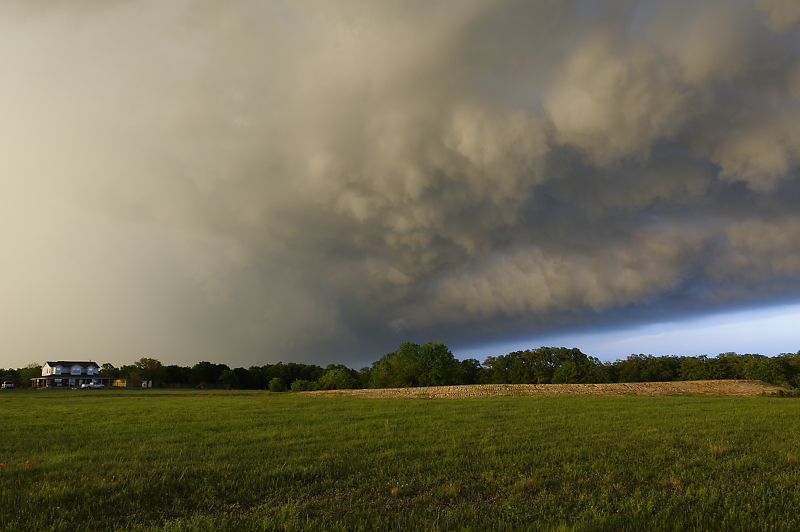
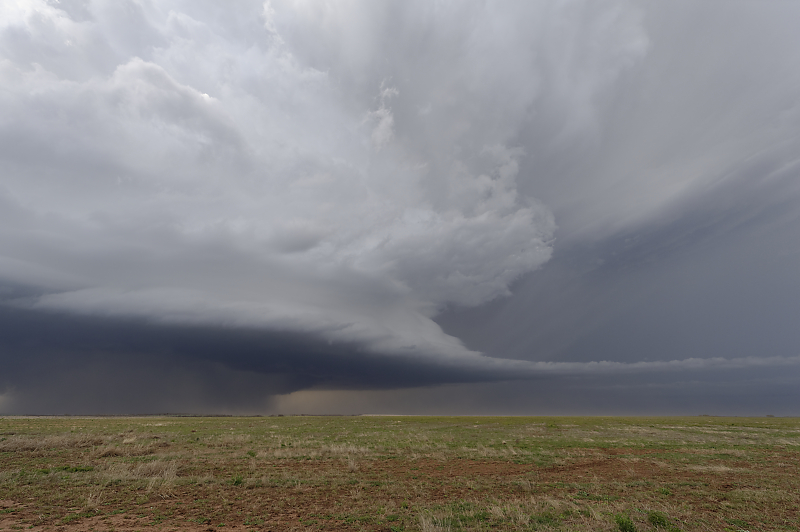
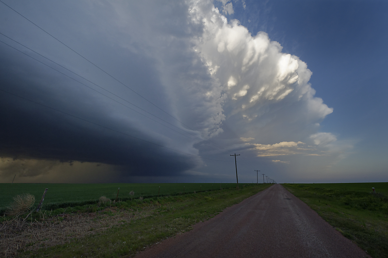
Cold air flowing in front of the storm has forced the updraft aloft, creating the "whale's mouth" appearance where turbulent cold air is interacting with warm air.
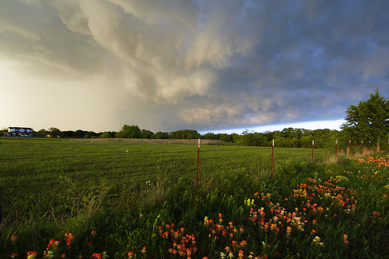
Wide-angle view with mid-April wildflowers in full bloom.
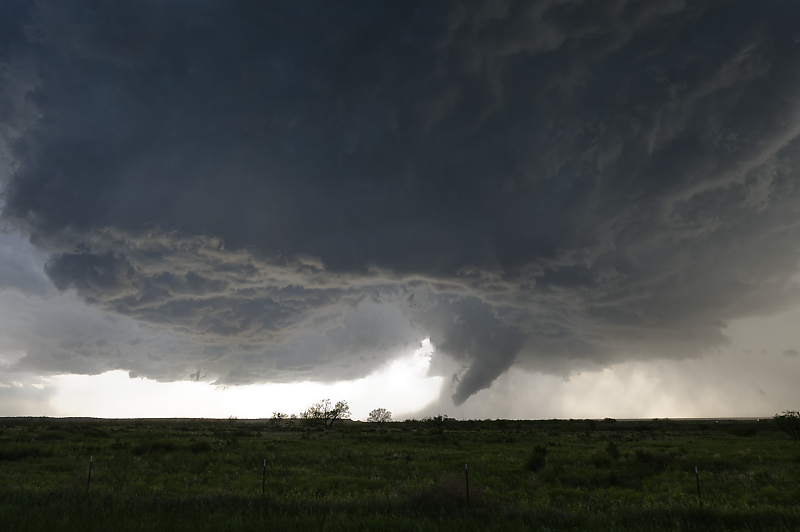
April 27: West Texas Tornado
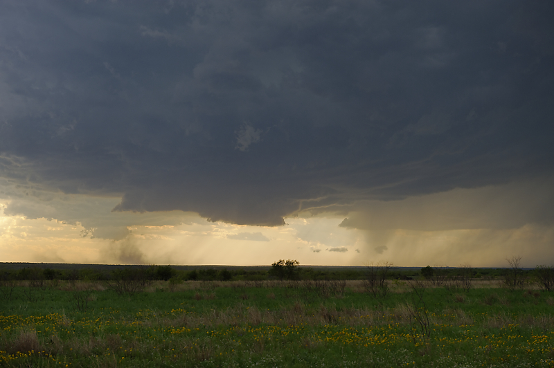
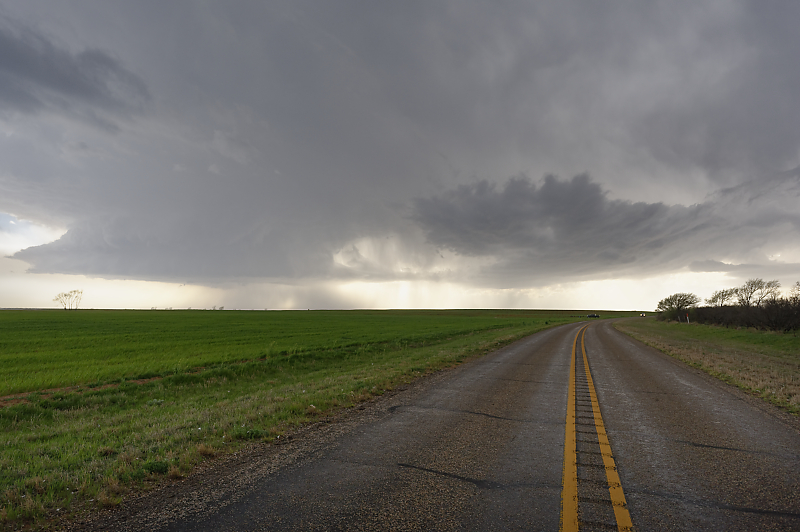
Severe storm near the west Texas town of Aspermont. Marginal shear and CAPE today, so no tornadoes are expected.
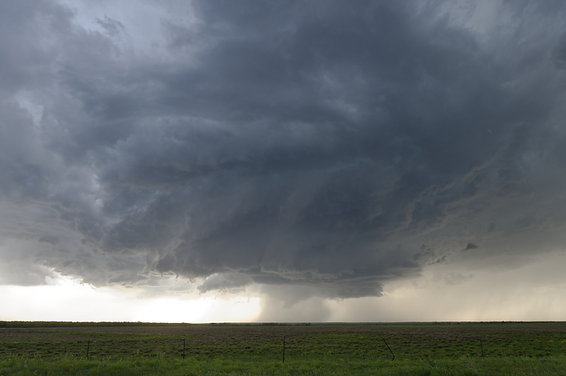
Updraft shows signs of rotation.
Lowering could be harmless scud clouds or a dangerous funnel cloud.
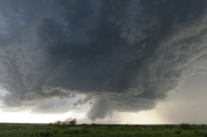
Funnel cloud reaches near the ground, as tornado circulation touches down.
Ragged funnel of a weak tornado.
Wide-angle view. Fantastic sight on a day when the outlook was only for hailstorms.
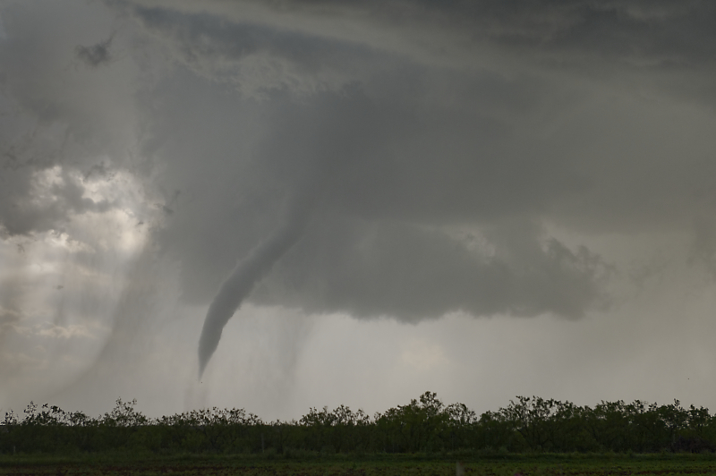
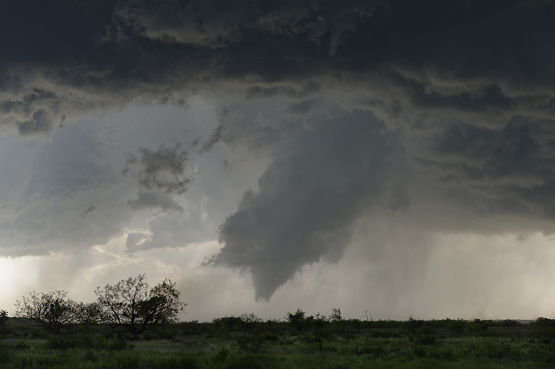
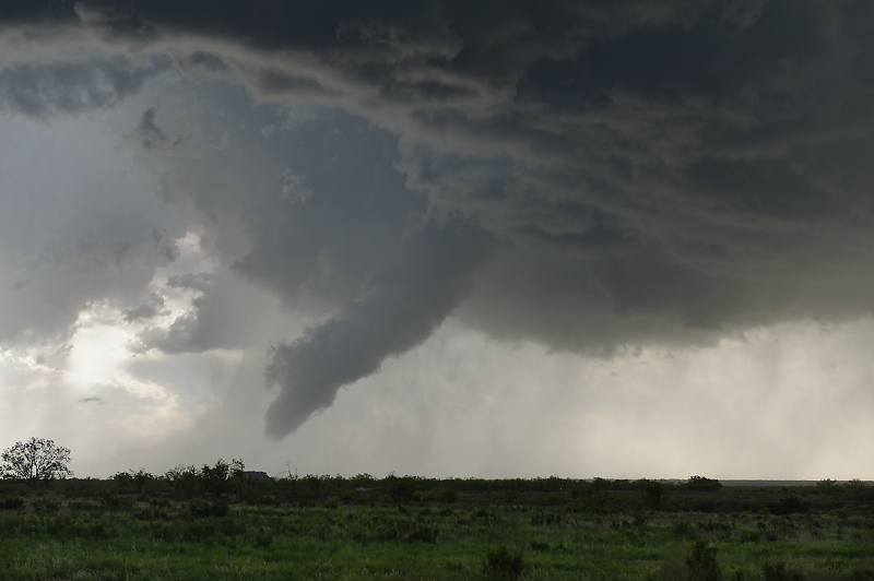
Soon the full tornado circulation is visible.
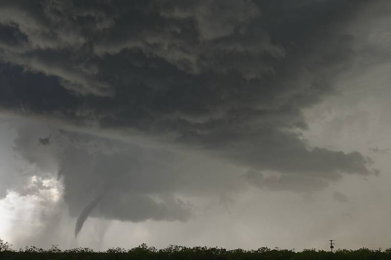
Clear area on the left is the rear-flank downdraft (RFD) that helped generate this unexpected tornado. RFDs are a key ingredient in tornadogenesis.