May 30: Western Kansas Supercell
Tower goes up northwest of Dodge City.

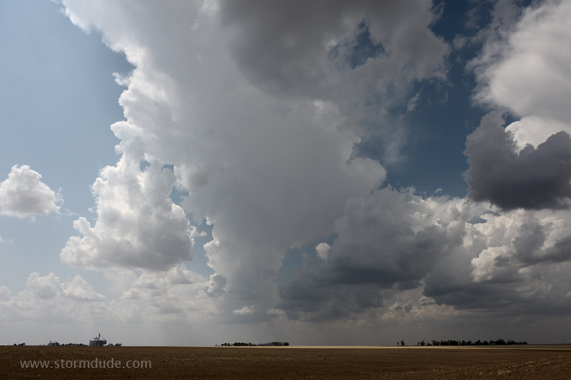
Weak thunderstorm near Jetmore. Good instability, but mid-level winds won't pick up until early evening.
Ninety minutes later, the storm rapidly strengthens.
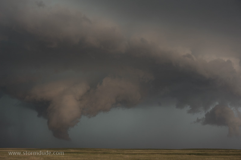
Updraft begins to rotate.
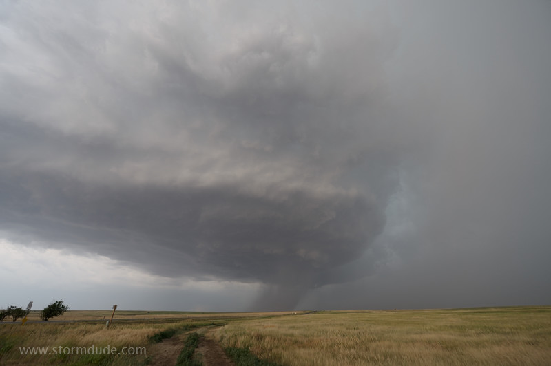
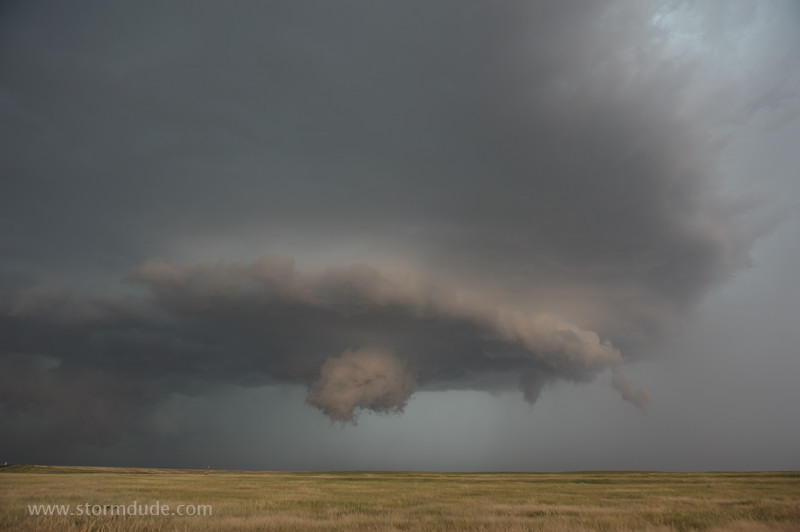
Storm soon takes on a breathtaking sculpted appearance.
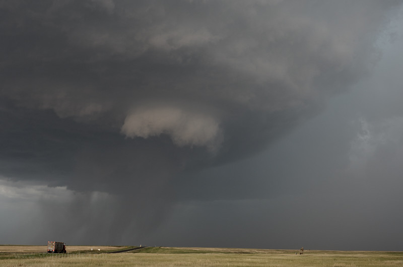
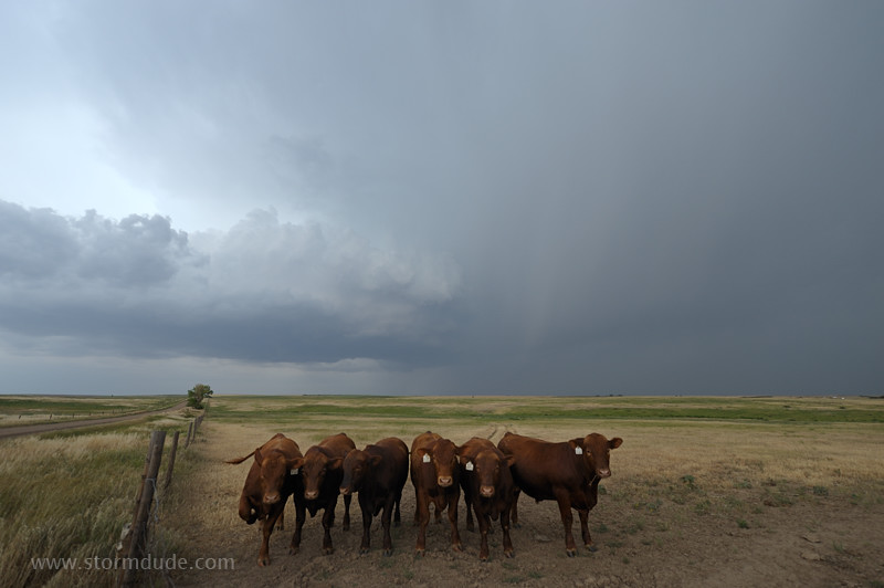
Cattle truck heading north into the storm.
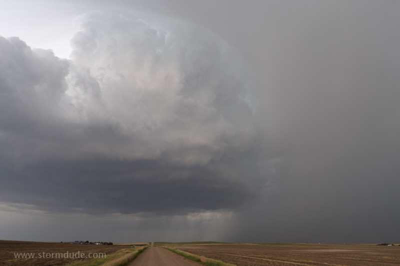
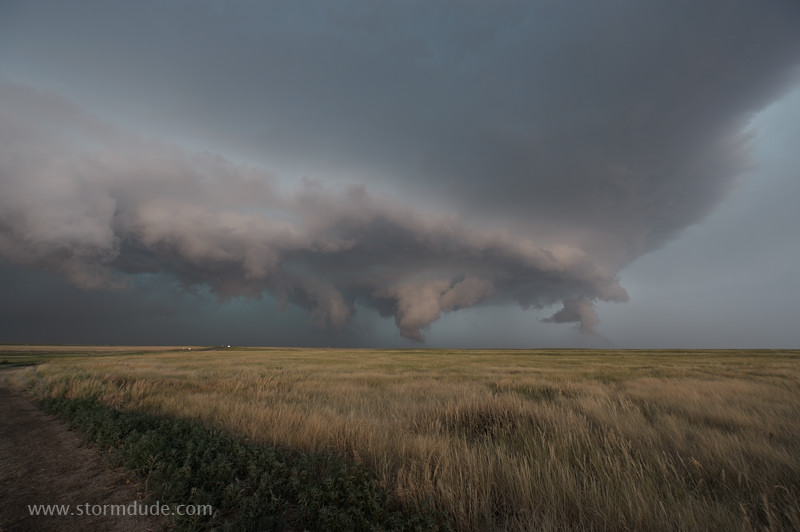
Wide-angle view.
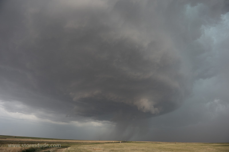
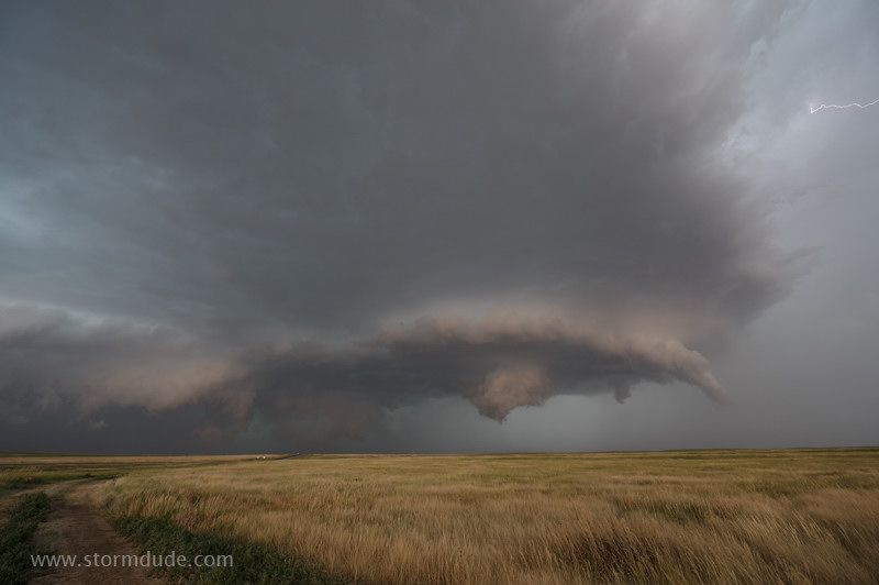
Spinning like a top.
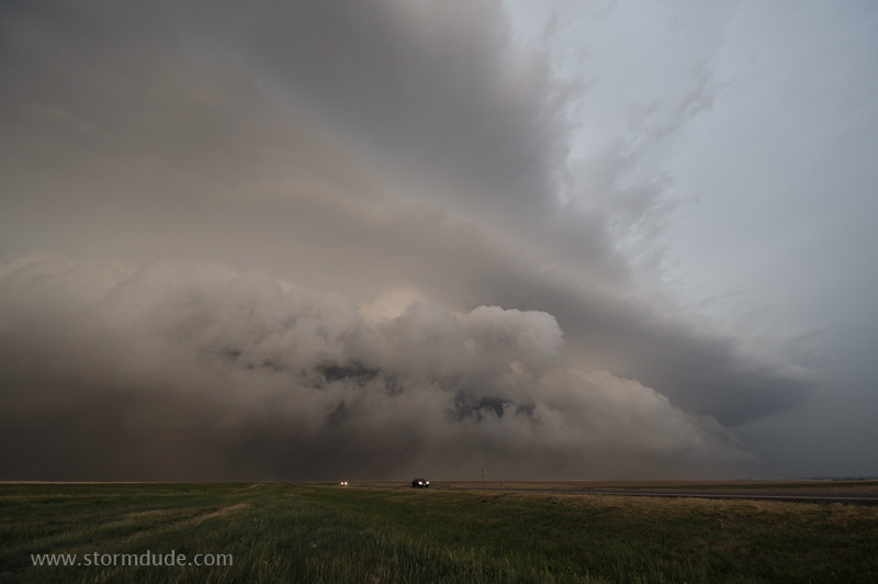
Squall line approaches the nearly stationary storm.
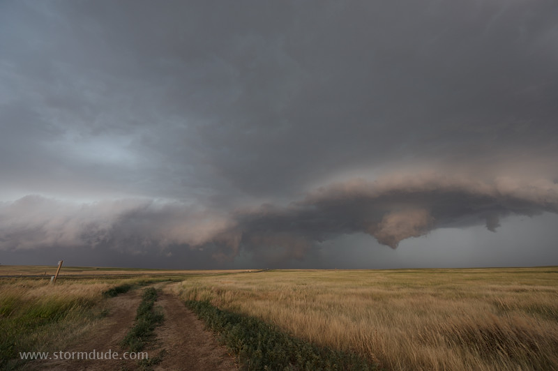
Pastel lighting is created by evening sun reflecting off a line of cumulus to the south.
Intense gust front is now just a mile to my north.
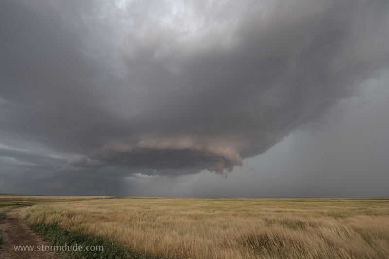
Scenic thunderstorm over a Kansas prairie.
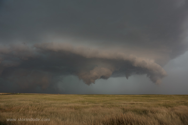
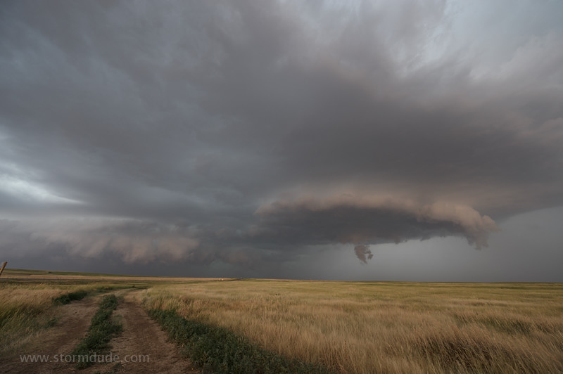
Rotation increases just before the squall line consumes my storm.
All this occurs in the pasture right in front of me.
One last look before I get consumed also. After dodging gustnadoes at the south end of Jetmore, I escape ahead of the gust front.
An unbelievable sight just south of Jetmore.
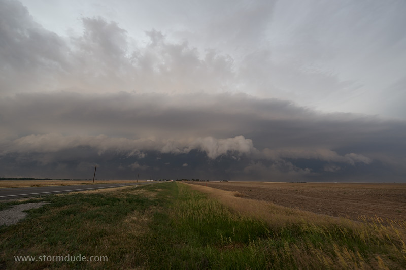
Final look at the leading edge of the squall line.