May 24: El Reno - Piedmont, Oklahoma Tornado
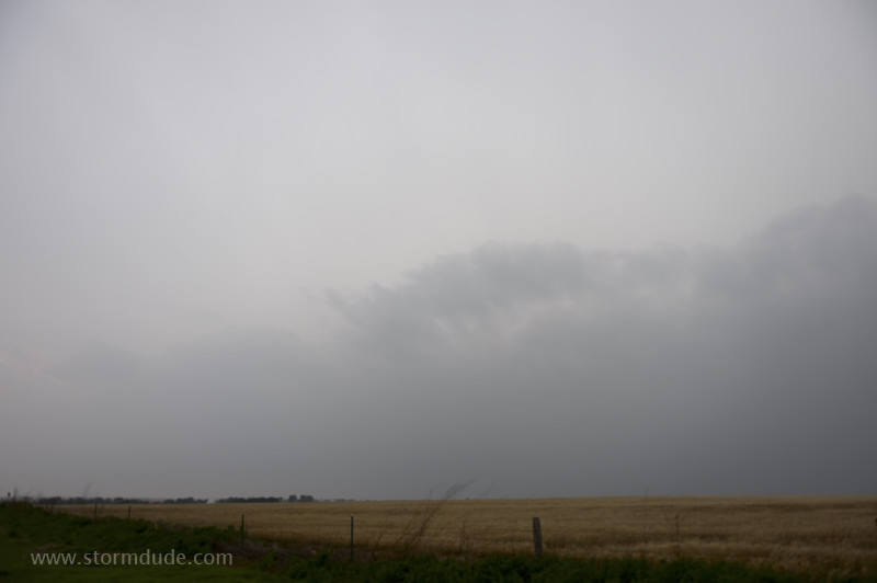
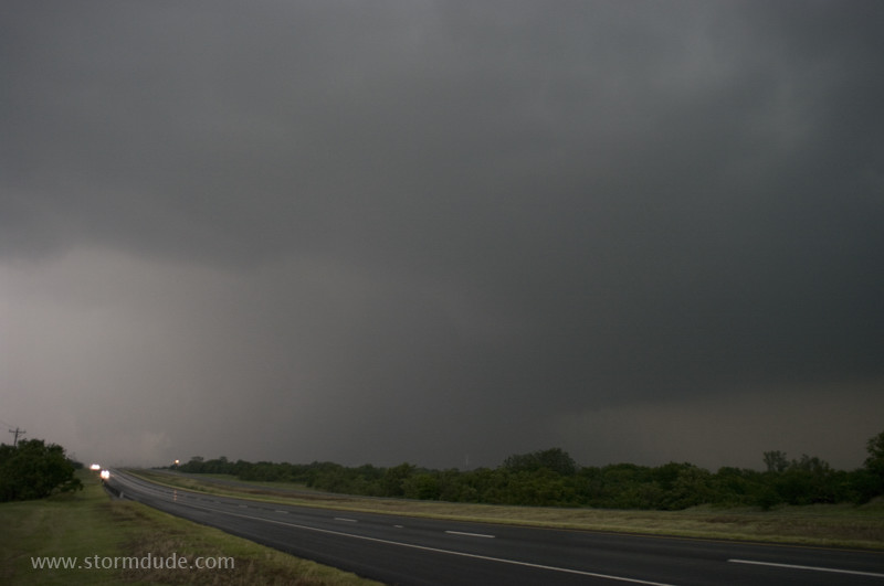
Ten miles north of El Reno on a day with the classic ingredients for high-end severe weather: strong southerly winds transporting highly unstable air from the Gulf of Mexico, an active jet stream creating very strong shear, a dryline in western Oklahoma to trigger storms, and enough separation between storms to allow sustained rotation and intense, long-track tornadoes. This is my view to the southwest, at the leading edge of the most powerful supercell.
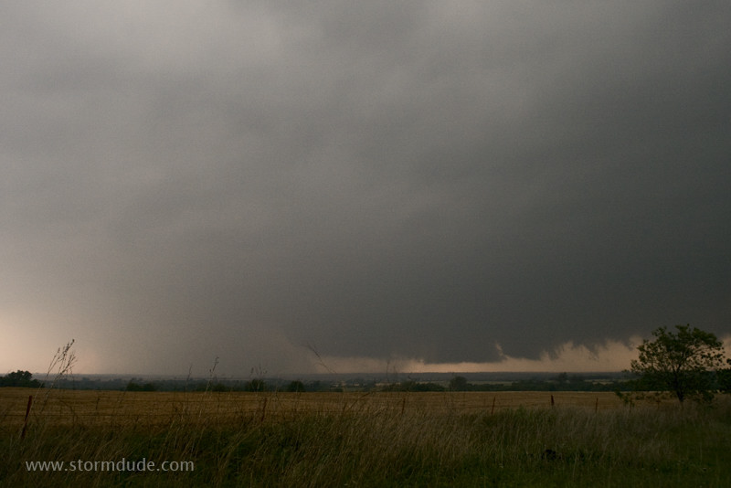
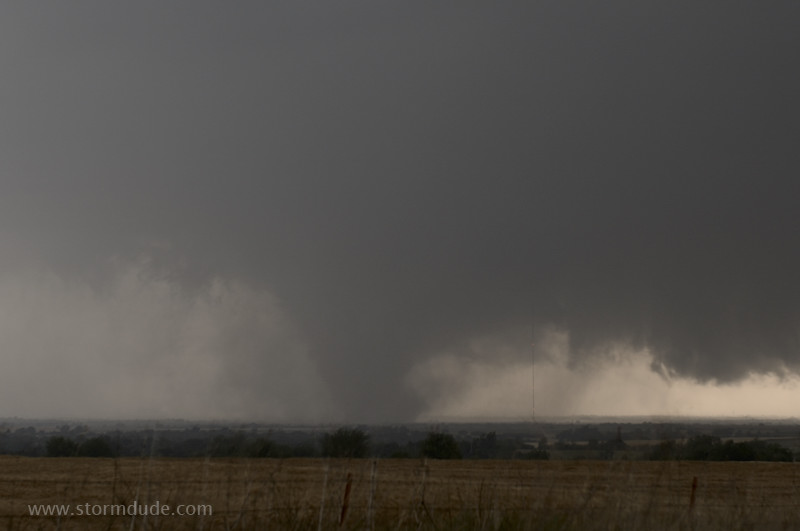
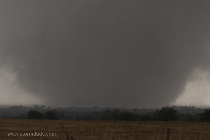
I relocate to Northwest Expressway just west of Piedmont, where I have a clear view to the west and southwest. What appears to be a cloudburst is actually a violent, rain-wrapped tornado (rated EF-5).
The rain lessens, revealing a strong tornado a few miles to my west-southwest. Unusually dark conditions make photography difficult.
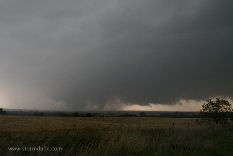
View of the tornado becomes clearer as it races towards me.
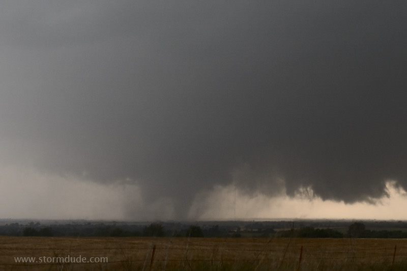
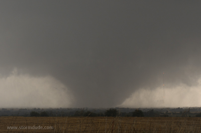
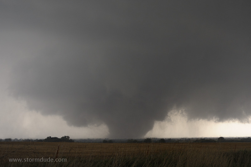
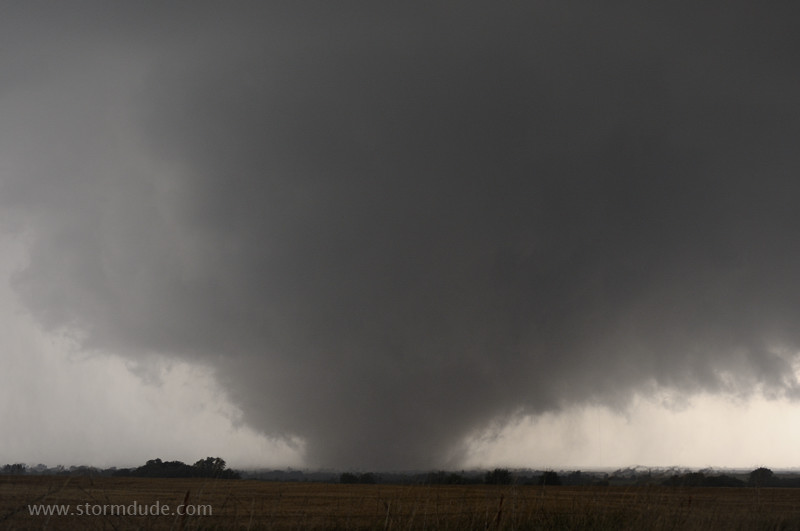
Tornado widens.
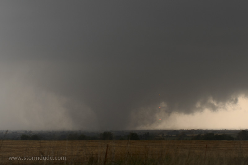
A minute later.
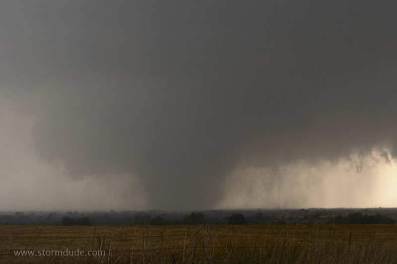
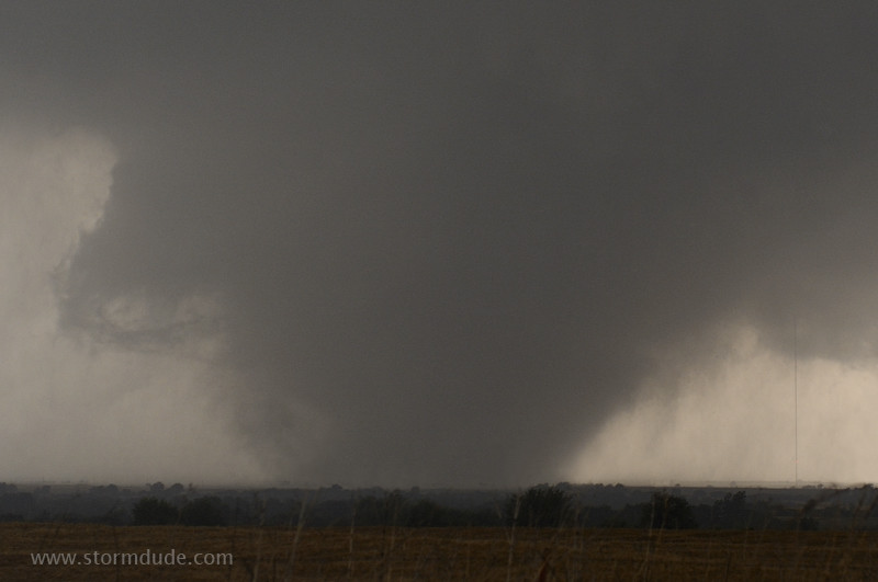
It continues to grow...
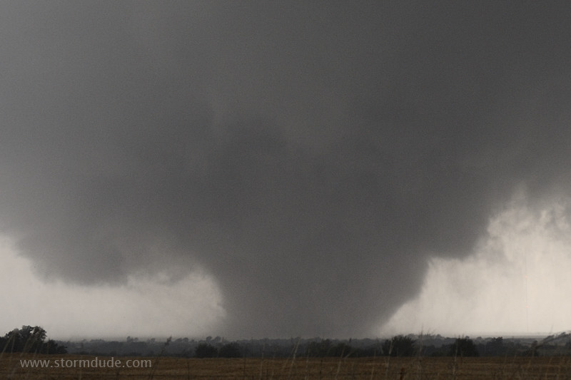
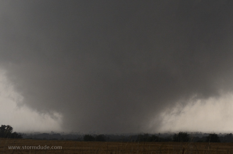
...as it moves east-northeast at 50 mph.
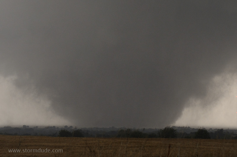
It takes on a wedge appearance.
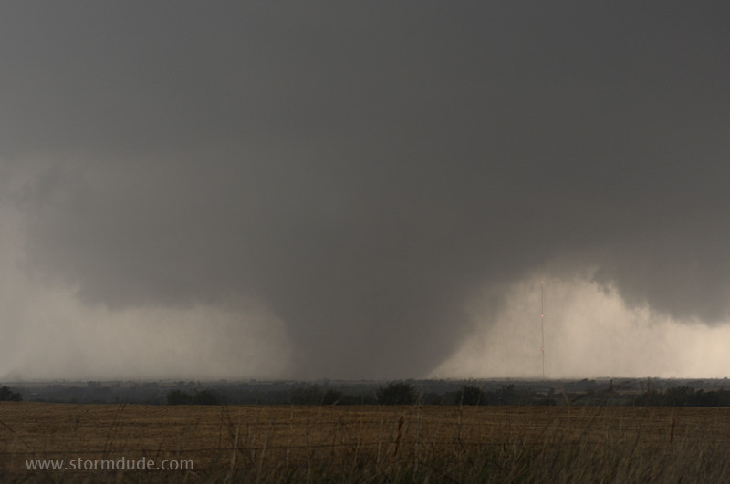
At this point, I realize the tornado isn't moving to my left or right, but just growing larger. It is headed directly for my position.
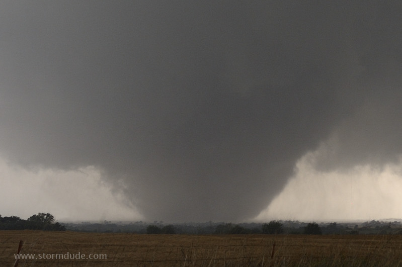
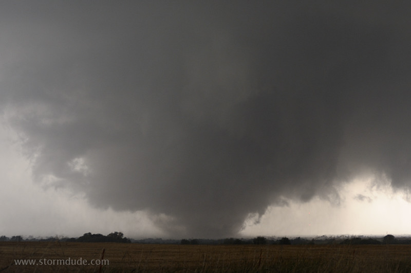
Large, intense tornado between El Reno and Piedmont.
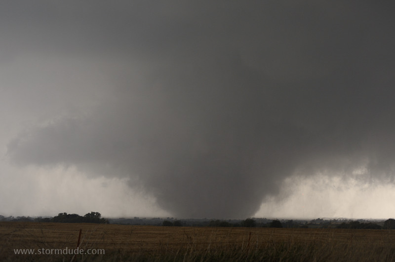
Wide-angle view.
Zoomed-in view shows cloud-on-the-ground appearance that can fool people who aren't paying attention.
The entire structure is rotating counter-clockwise.
Nature at its fiercest.
The large trees just in front of the tornado give an idea of its scale.
Another wide-angle view.
Close view of a large, violent tornado. There have been only two other F5 or EF-5 tornadoes in Oklahoma in the past thirty years (April 2, 1982 and May 3, 1999).
One last wide-angle photo before I head at a 45-degree angle away from the tornado's path.
Looking back at the tornado after it crosses Northwest Expressway. The tornado travels a total of 65 miles, from near Hinton to just northeast of Guthrie.
Roger Edwards has an outstanding account of this tornado from near my vantage point:
Stormeyes.org
I've also added a slide show:
El Reno-Piedmont Tornado