June 9: Southwest Nebraska Supercell
Thunderstorm develops in southwest Nebraska.
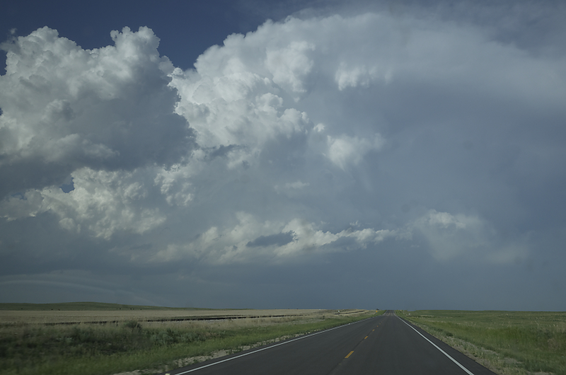
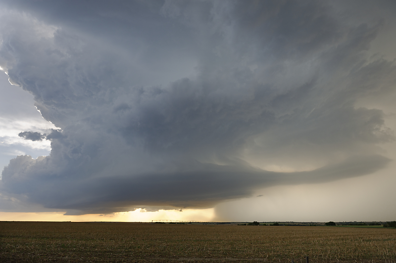
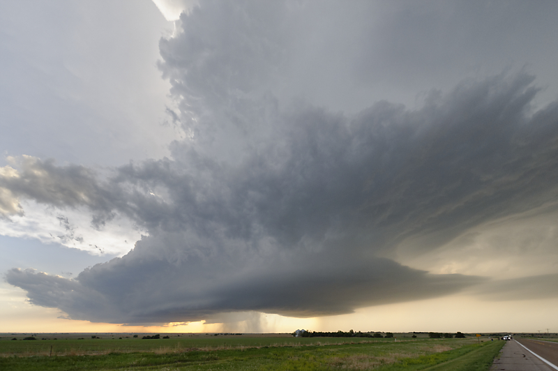
South of North Platte, we intercept this fantastic supercell.
Once again, we are driving south on Highway 83 as a supercell heads south-southeast.
We stop every 5 or 10 minutes for another view.
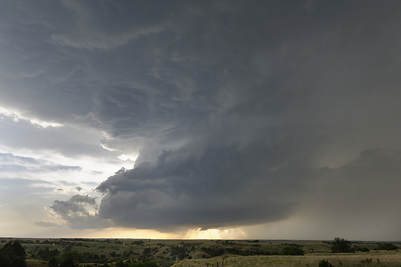
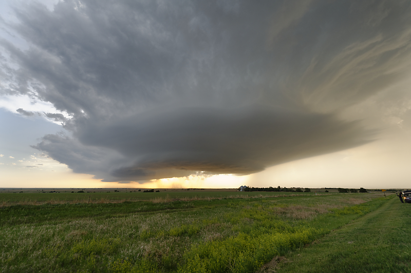
Looking west from Highway 83 between North Platte and McCook.
It is rare to have such a photogenic storm track next to a good, paved road
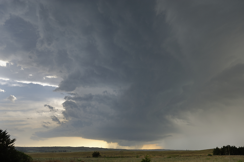
The supercell has moved very close to the highway. Fortunately, storm speed is slow enough to allow lots of stops and photos.
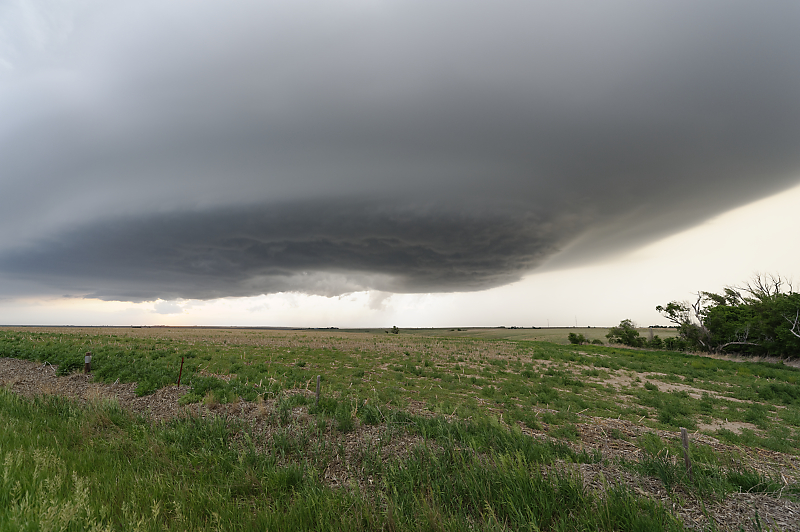
Wide-angle view shows the wonderful sculpted structure.
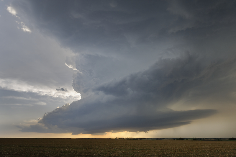
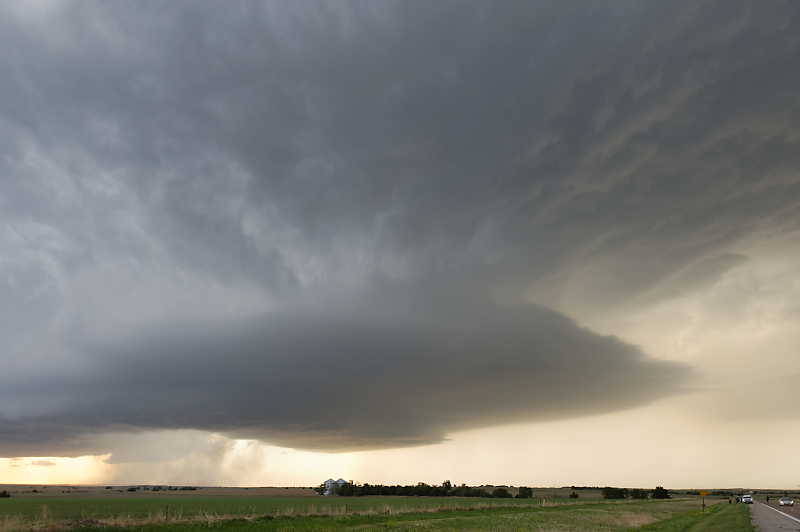
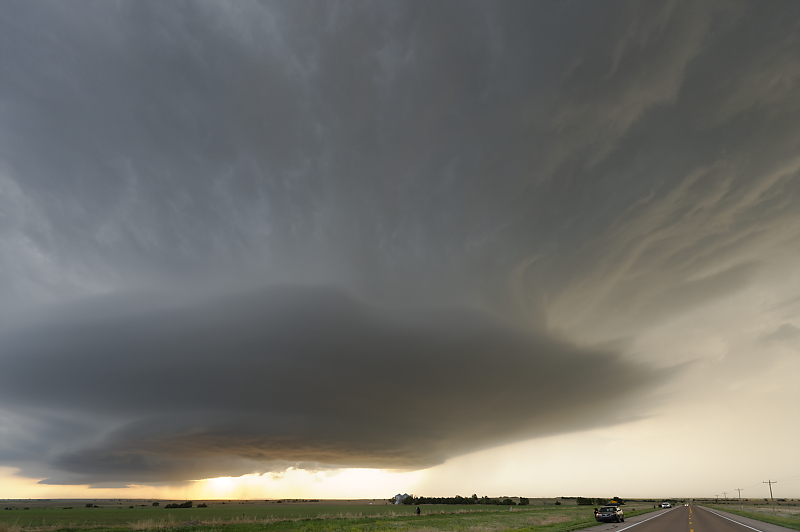
Not sure how to describe the feeling of proximity to this atmospheric beast.
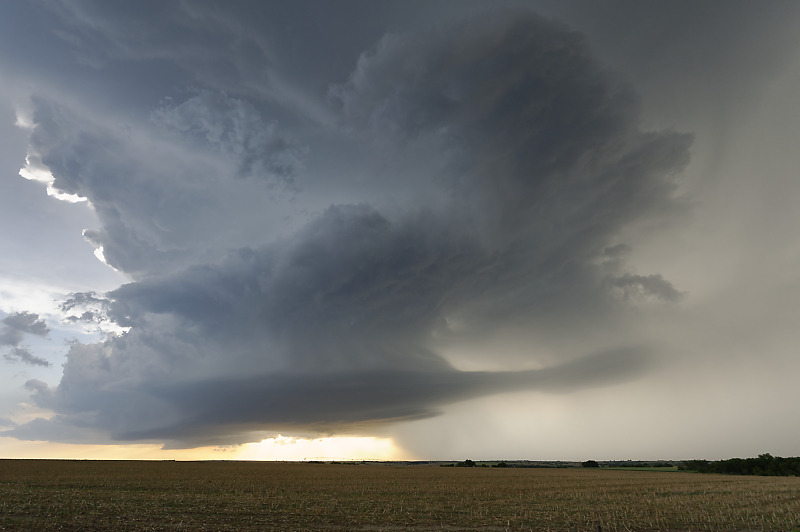
Constant shape-shifting.
Dozens of storm chasers are enjoying this storm.
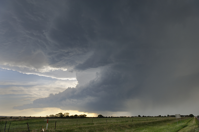
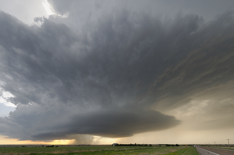
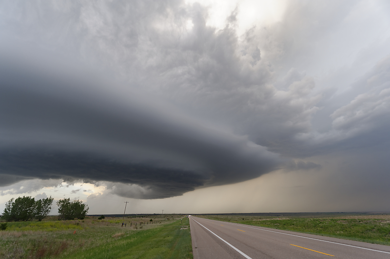
Wide-angle view. The storm is actually almost upon us.
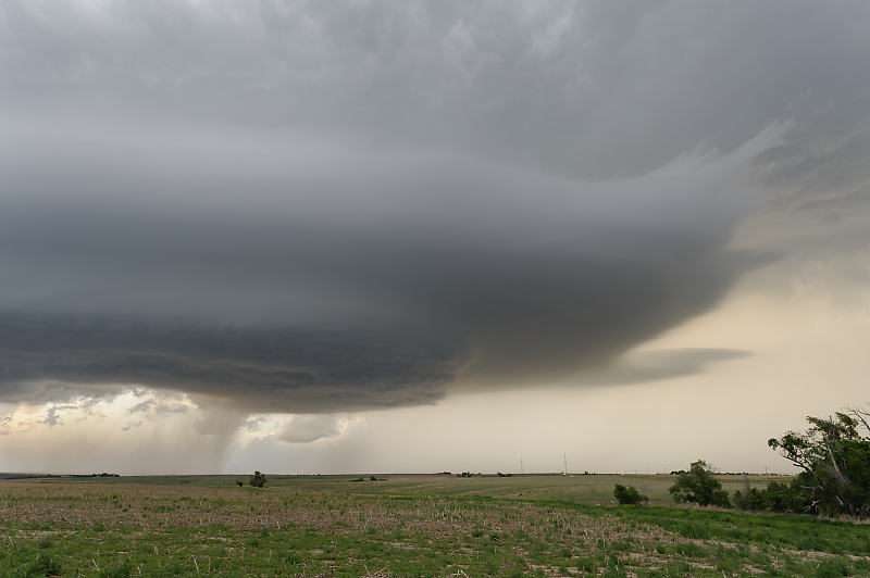
Another incredible view.
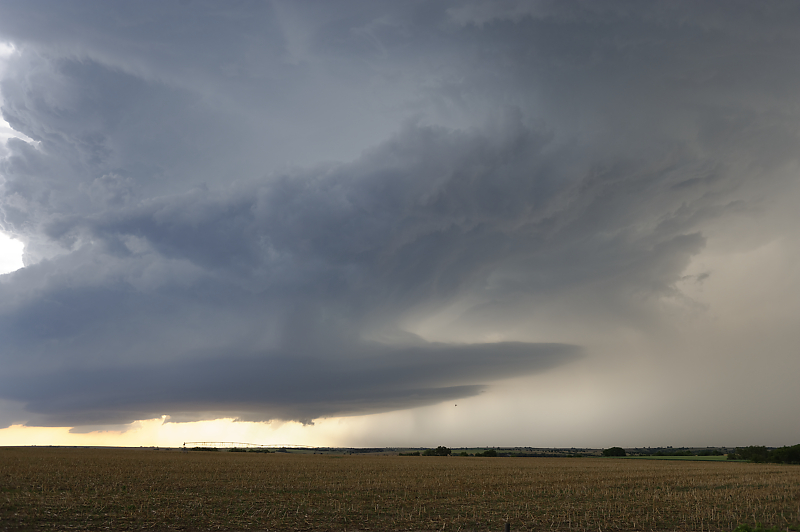
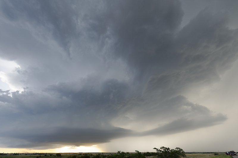
We drive south to get clear of the storm's path, and now the updraft base is just to our north.
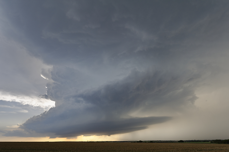
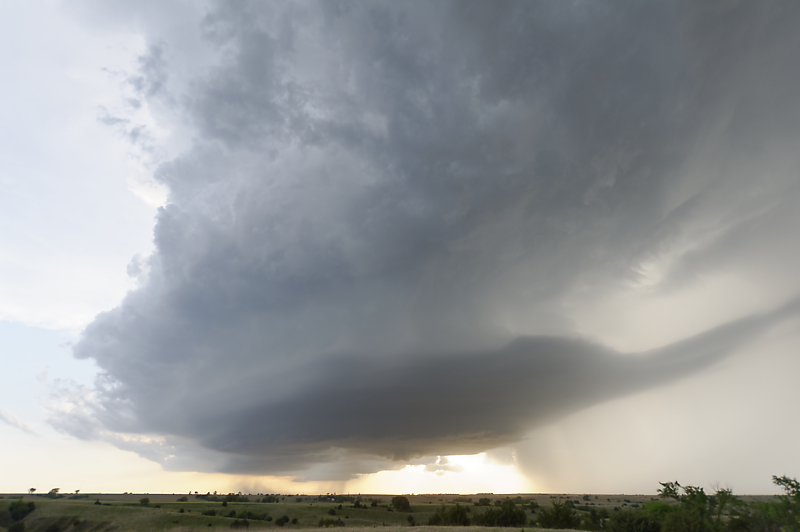
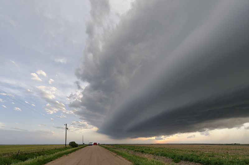
Ultra-wide-angle view (Nikkor 14-24mm f/2.8 zoom lens at 14mm).
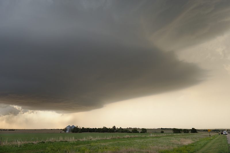
Could be interpreted as a flying saucer.
Alien mothership?
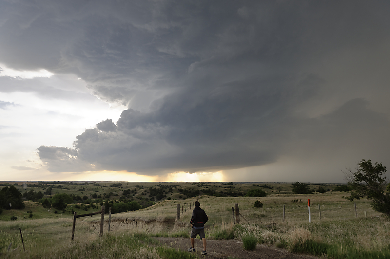
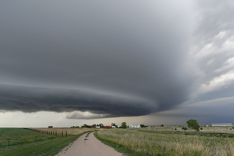
Looking north along Highway 83.
The main updraft closes in on us.
Looking west as the shelf cloud approaches.
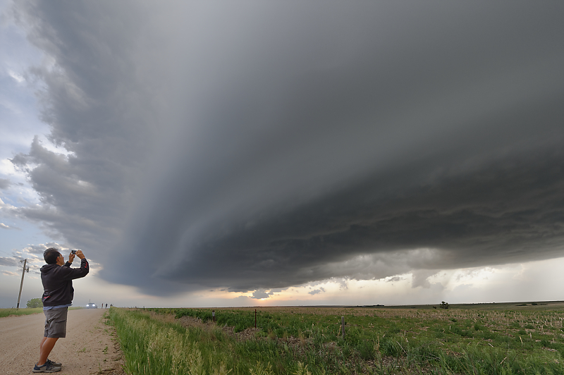
Bill enjoying a close encounter.
The zonal flow pattern has resulted in a very productive eleven days of storm chasing. With nearly daily shortwave troughs, we intercepted good storms on nine of those days!
We head another mile south and let the storm pass to our north.
Thunderstorm over a Nebraska farm at dusk. Incredible end to Bill's 2022 storm chase vacation!
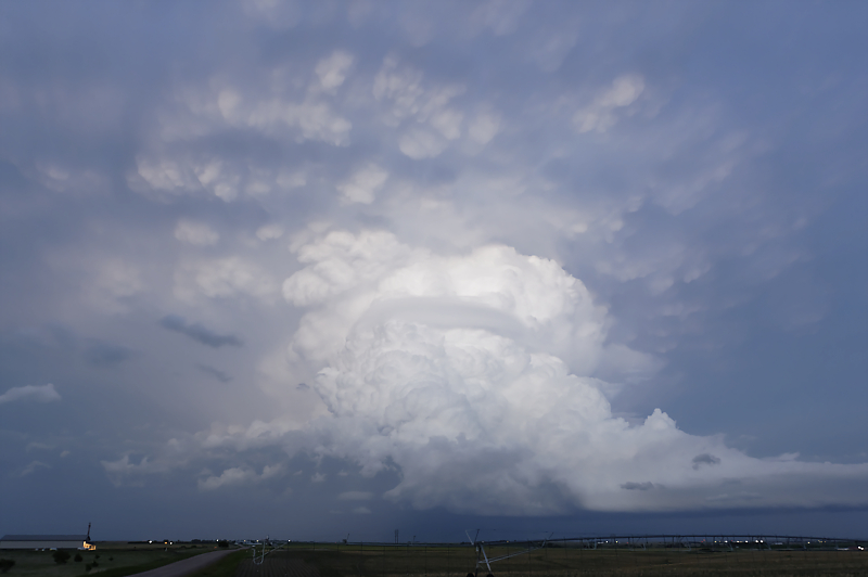
Backside of storm after sunset. The storm intensified after dark and we enjoyed a lightning display that pulsed like a strobe light.
June 12: Northeast Wyoming Storms
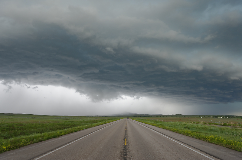
Northeast Wyoming to finish my storm chase season.
Large storm moves across the northern High Plains.
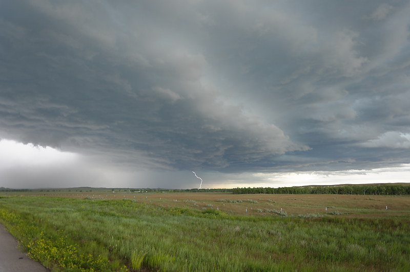
View under leading edge of severe thunderstorm.
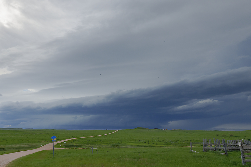
Northeast of Gillette, Wyoming.
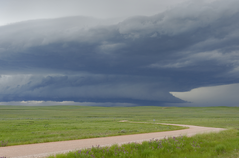
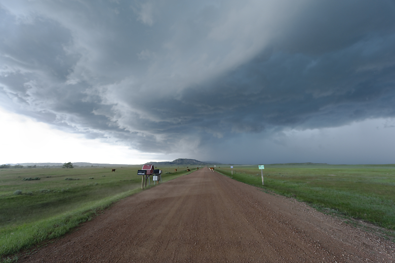
Scenic storm above grazing land west of the Black Hills.
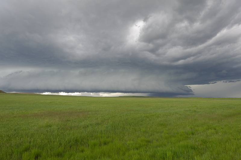
Final storm of my 2022 storm chase season as a summer weather pattern settles in across the central U.S.