May 24: Selden, Kansas Tornado
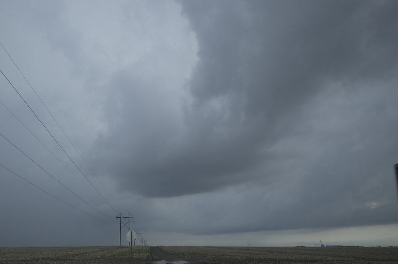
New updraft develops along a stationary front in northwest Kansas. We intercepted this updraft rather than pursue a tornado-warned storm further west.
Soon we spot a wall cloud (on the left), and a new lowering much closer to us (center right).
Tornado briefly touches down east of Colby, Kansas. This is Bill's first tornado.
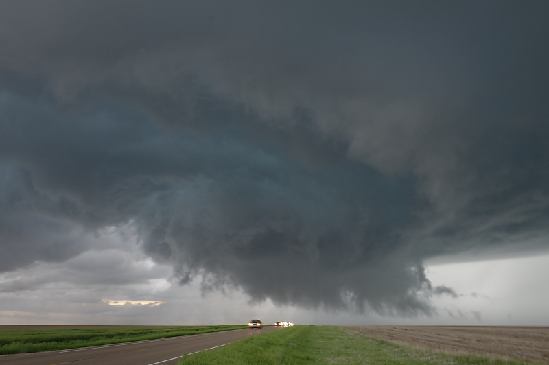
We drive a little north to find a good viewing position (between Colby and Rexford).
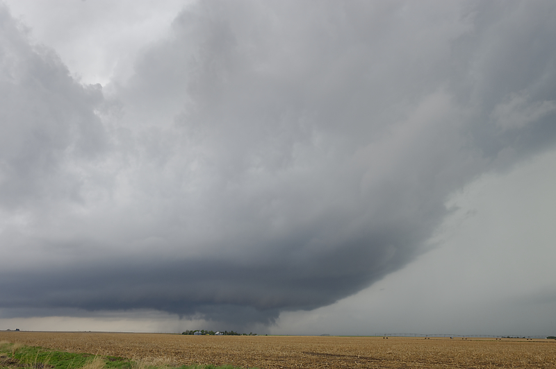
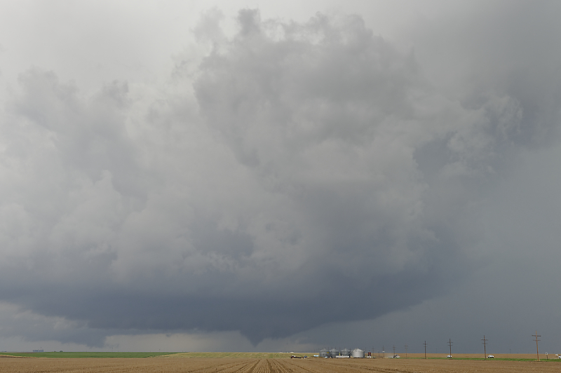
Main updraft and wall cloud of a tornadic supercell.
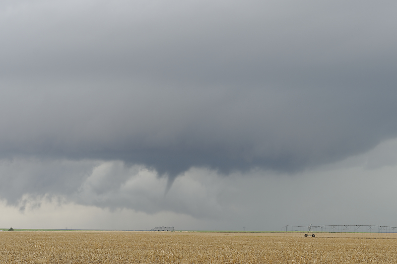
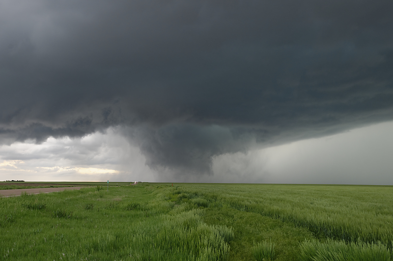
One of several brief tornado touch-downs. There is no condensation funnel, but the circulation is on the ground (according to storm chasers who are much closer).
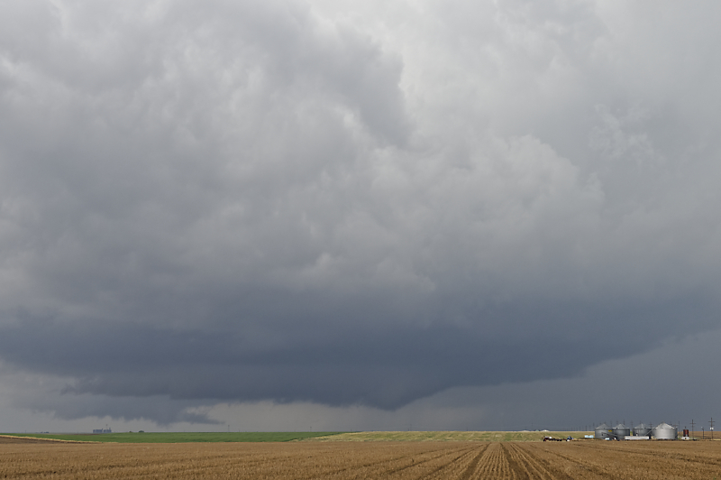
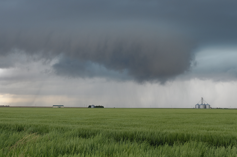
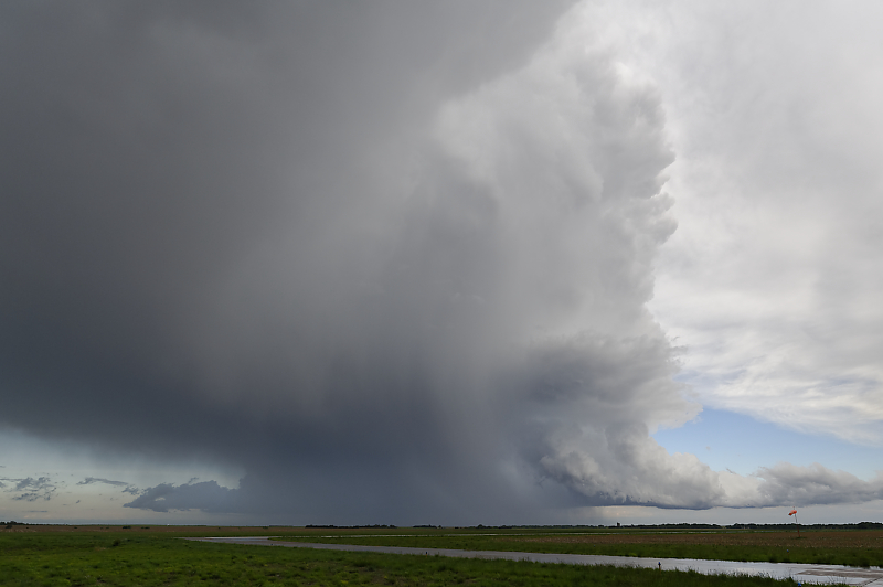
Shelf cloud (on the right) marks the forward-flank downdraft of this storm. Wall cloud is on the left (behind the grain bins).
We've been watching this slow-moving storm from this vantage point for over an hour. A couple of dozen storm chasers have joined us.
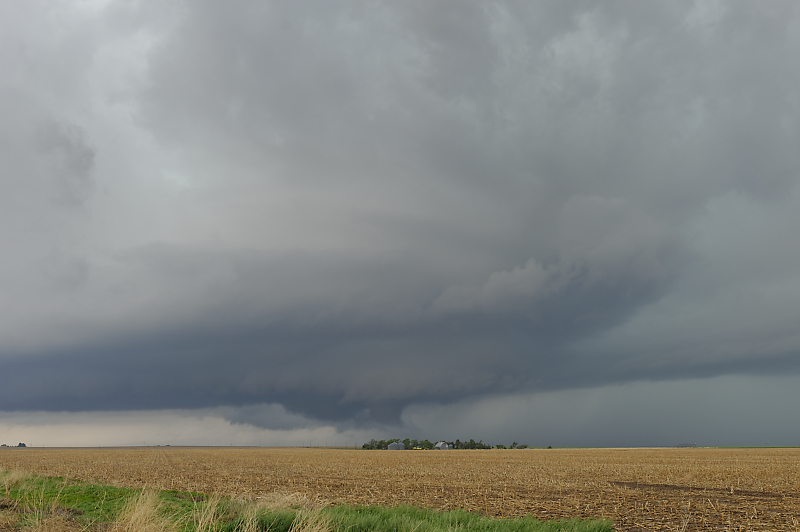
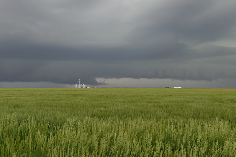
Ragged wall cloud as the supercell crosses wheat fields.
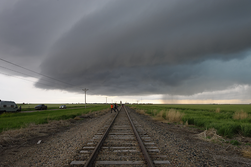
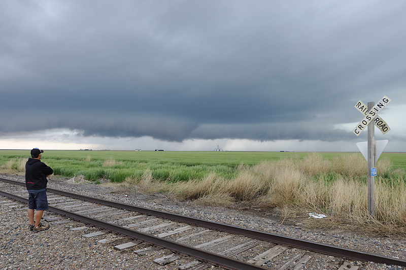
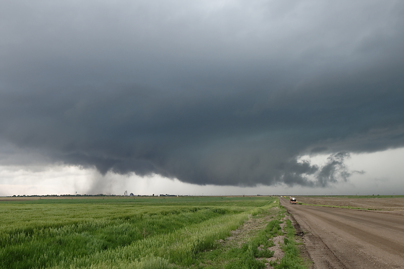
Looking west-southwest at the rear flank of the storm. To get back ahead of the storm, we soon drive 20 miles east-northeast to the small town of Selden, Kansas.
After we stop just east of Selden, a small tornado touches down.
Fortunately no injuries occur with this tornado.
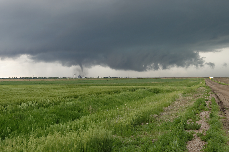
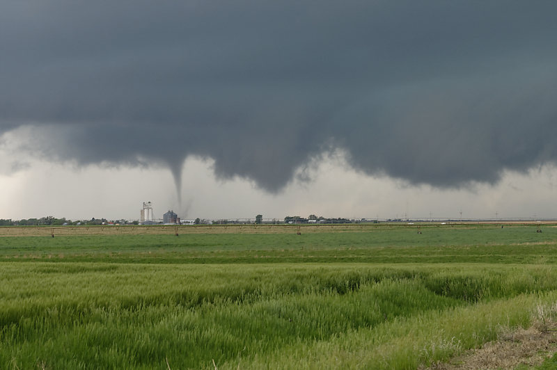
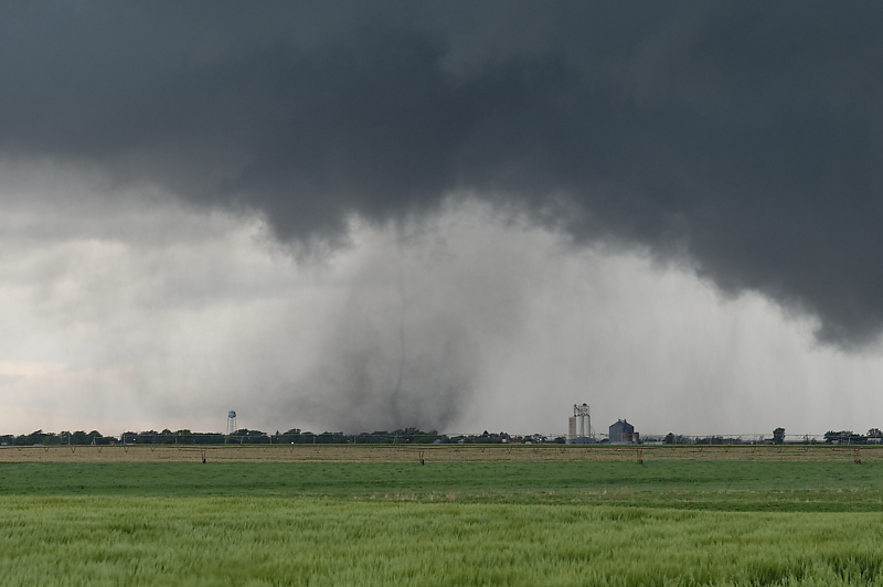
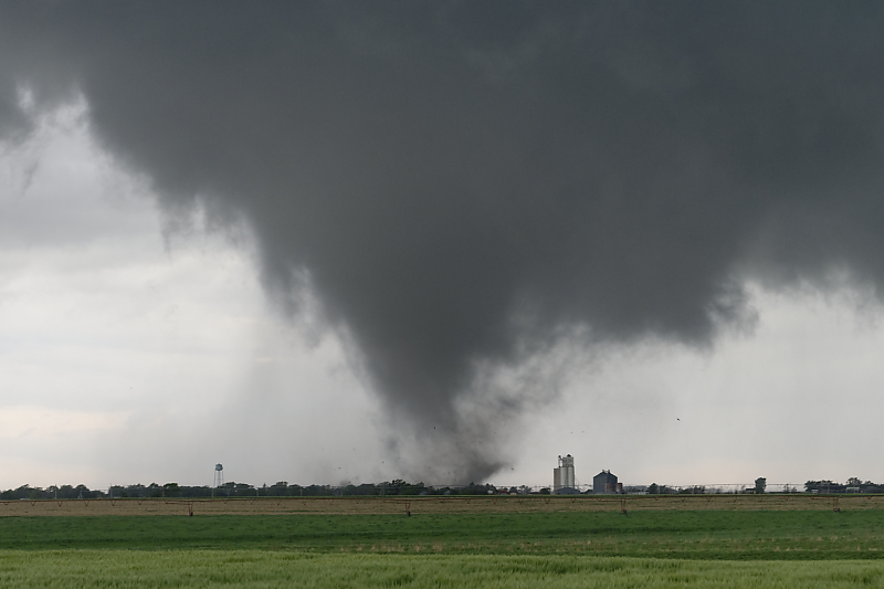
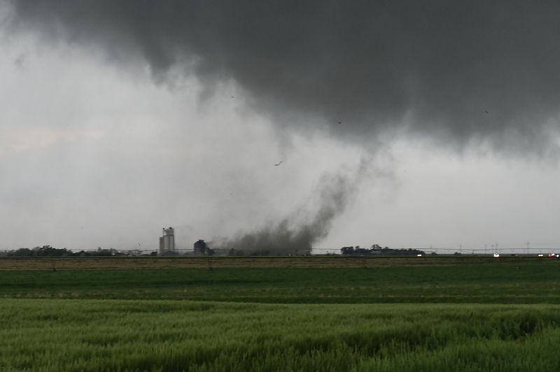
Looking west at the wall cloud and tornado as it enters the town.
Wide-angle view of the storm.
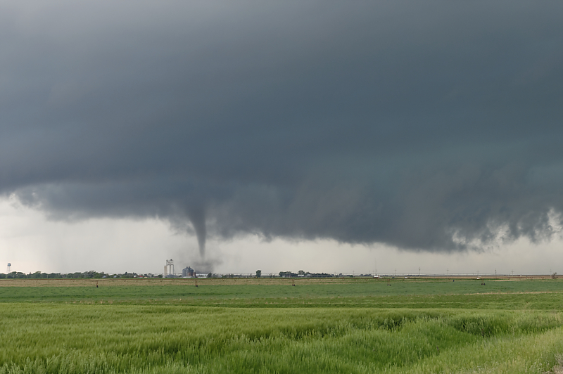
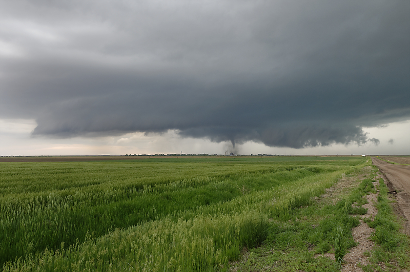
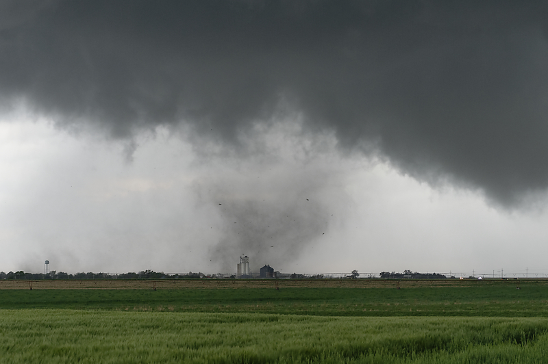
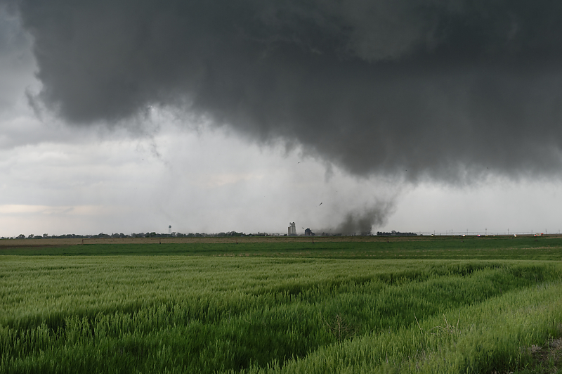
Small cone-shaped tornado that is later rated EF-1.
Debris from the storm is now visible beneath the condensation funnel.
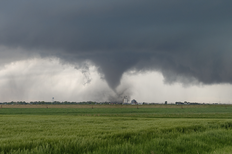
Modest levels of CAPE and shear keep this tornado from becoming more intense (according to computer models, 30 knots at 500 mb, 20 knots at 850 mb and about 1500 CAPE).
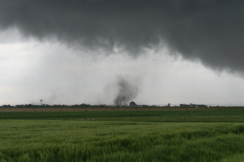
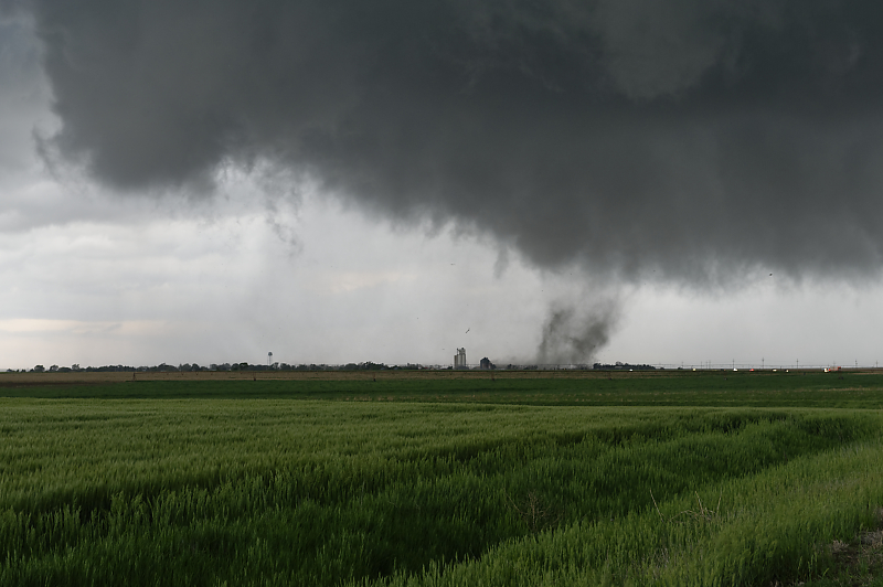
Due to the marginal moisture, the condensation funnel often doesn't reach the ground, although damaging winds are occurring in town.
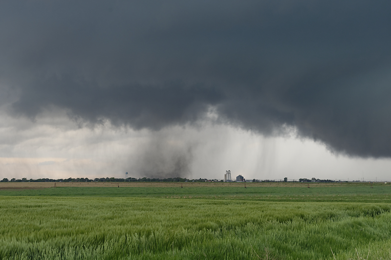
Funnel cloud isn't even visible here, although the ground circulation is visible with debris.
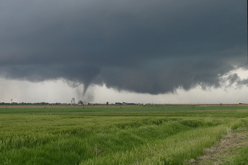
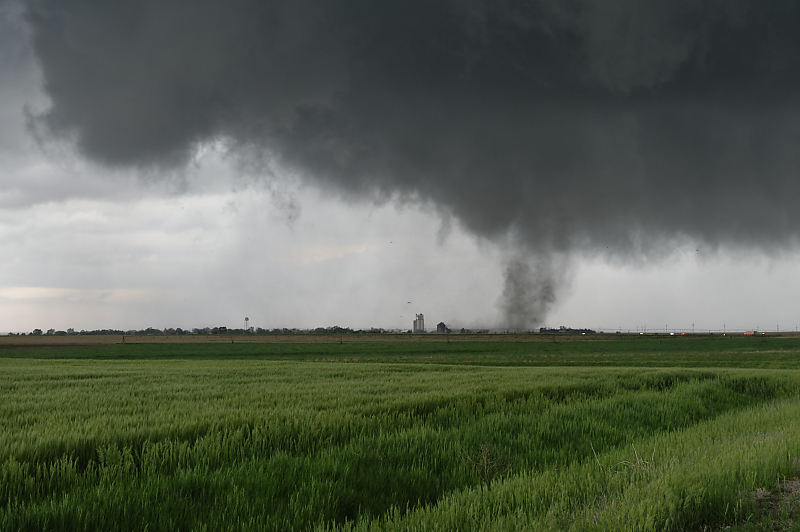
Thin needle appears in the middle of the tornadic wind circulation.
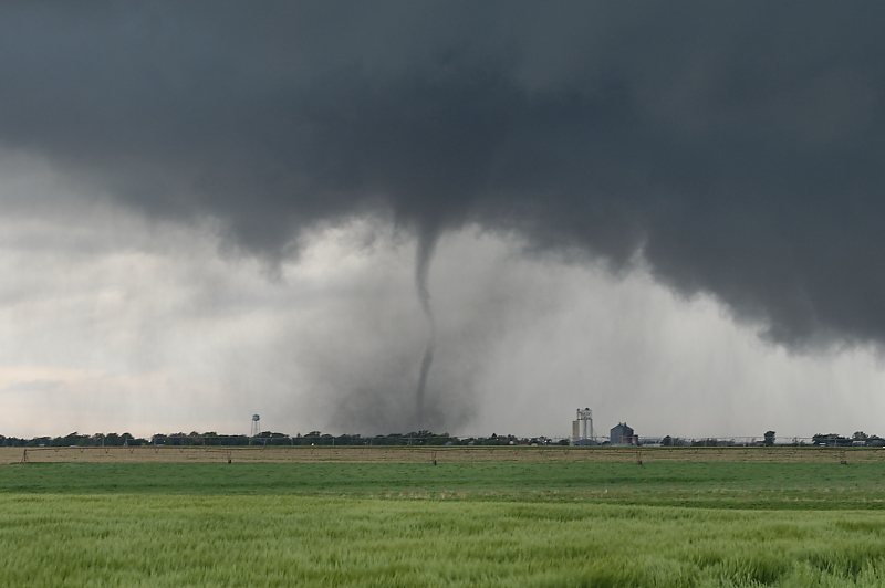
It rapidly enlarges.
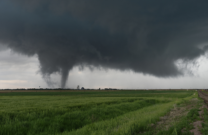
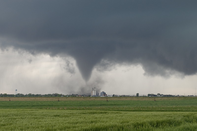
Two and one-half minutes later, a stout tornado is visible in the town of Selden.
A minute later.
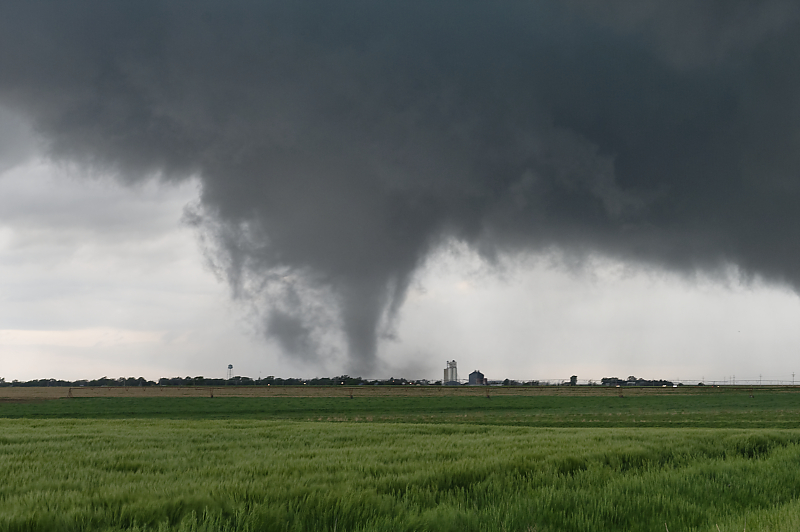
The tornado constantly evolves.
Zoomed-in view.
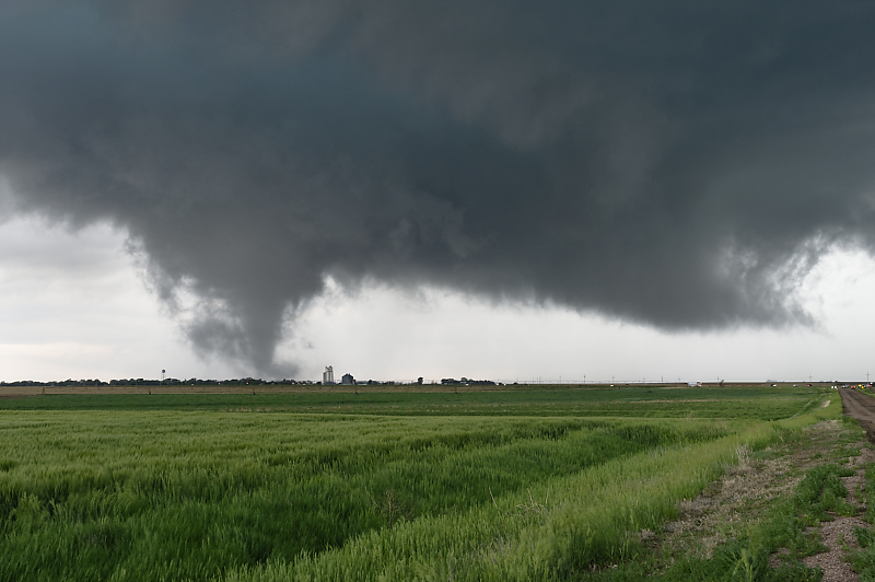
One minute later, the condensation funnel agains disappears.
Debris is lofted high in the air.
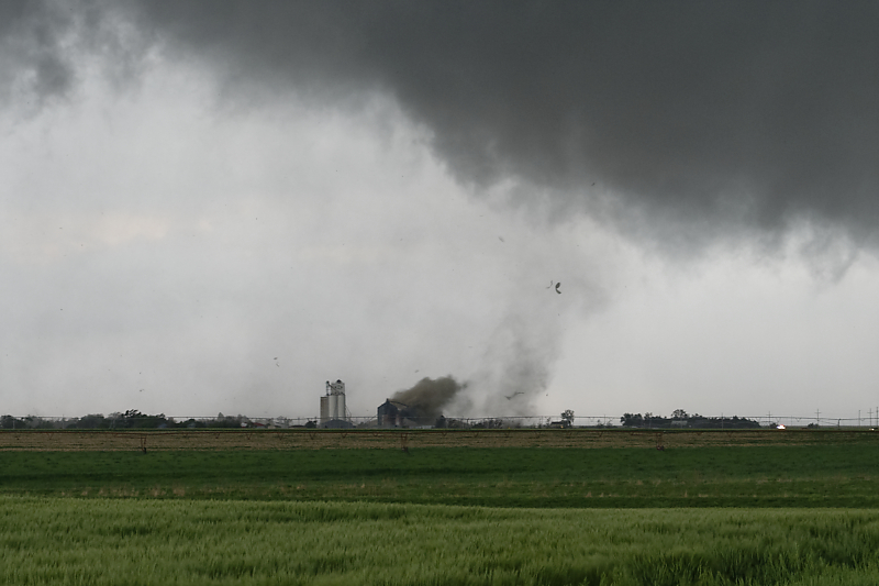
Tornado hits a grain storage bin.
Grain marks the tornadic circulation.
Grain being sucked up into the tornadic storm.
A couple of seconds later.
The tornado weakens.
We move east a mile to stay ahead of this rotating wall cloud. When my exit route lies directly in the path of a wall cloud or tornado, I always leave an extra buffer for safety. The amount of the buffer depends on the speed and intensity of the storm, as well as the amount of traffic (i.e. crowds of storm chasers and local sightseeers). (See my 5-31-13 chase account)
Watching the wall cloud from a safe distance. The supercell soon weakens. We watched this slow-moving storm from close range for over 2 1/2 hours, a truly amazing experience.
We intercept another supercell at dusk. Today easily ranks in the top ten of all storm chases for me.