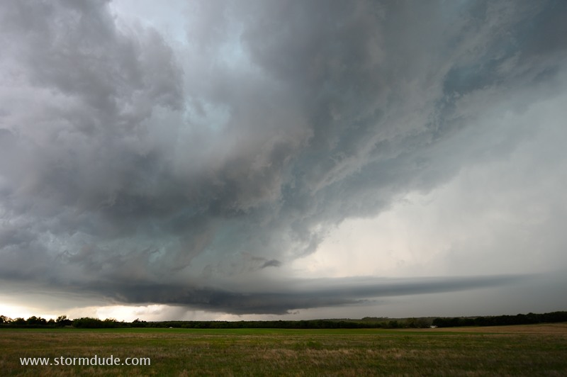
Supercell over rural north Texas (April 11).
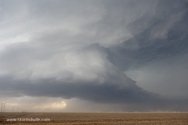
Dusty supercell in the Texas Panhandle (April 15).
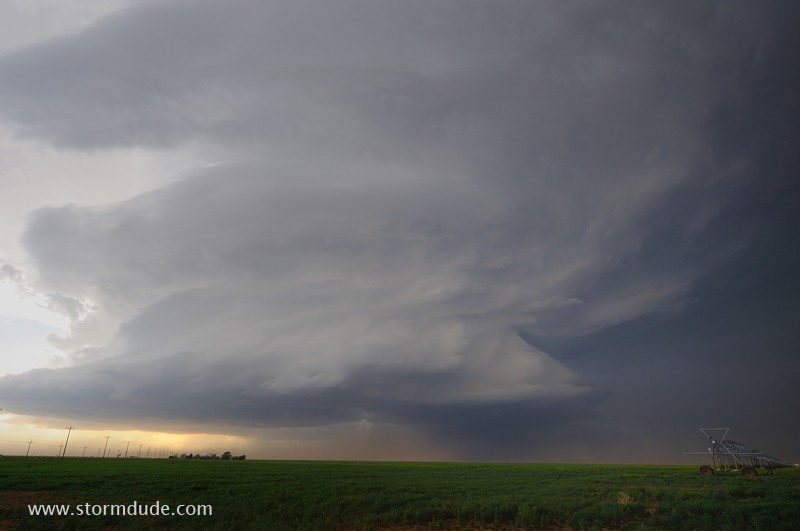
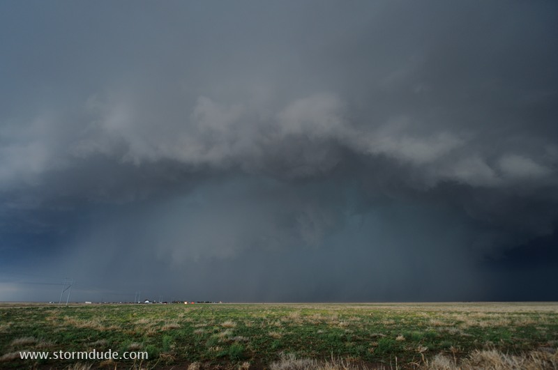
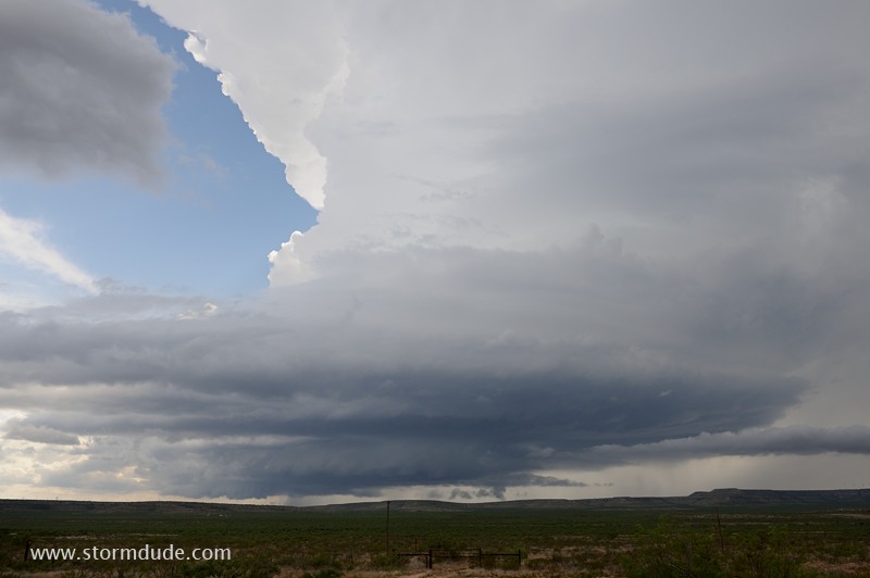
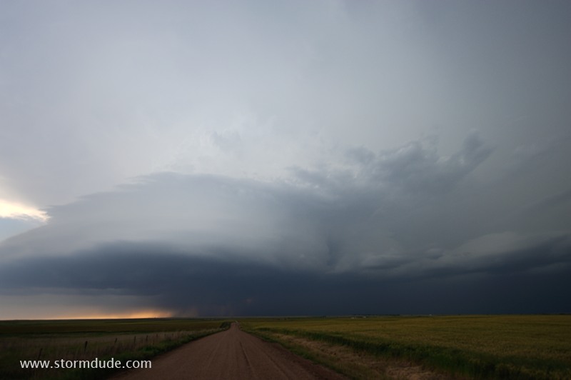
Dramatic storm over farmland near Stratford, Texas (April 15).
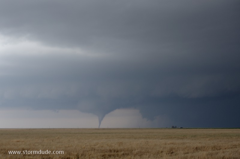
Tornado forms in the Oklahoma Panhandle (April 15).
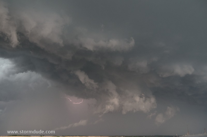
Cloudburst over Eva, Oklahoma (April 15).
Turbulent thunderstorm clouds near Junction City, Kansas (April 24).
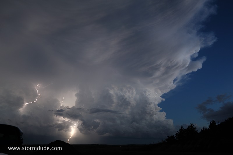
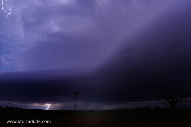
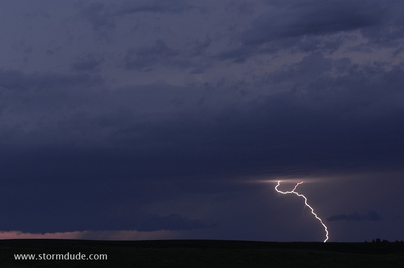
After-dark lightning show west of Salina, Kansas (April 24).
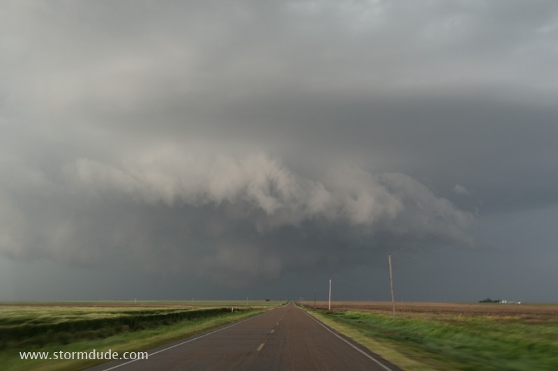
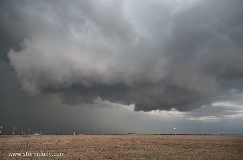
Squall line near the Gloss Mountains in northwest Oklahoma (April 26)
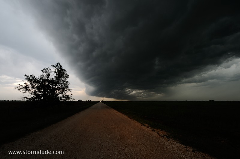
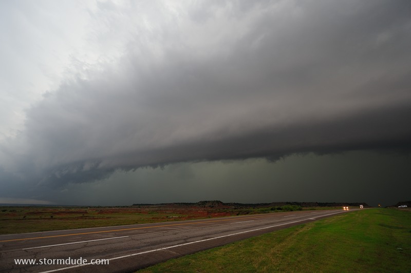
Shelf cloud over a dirt road west of Enid, Oklahoma (April 26).
West Texas supercell (April 28).
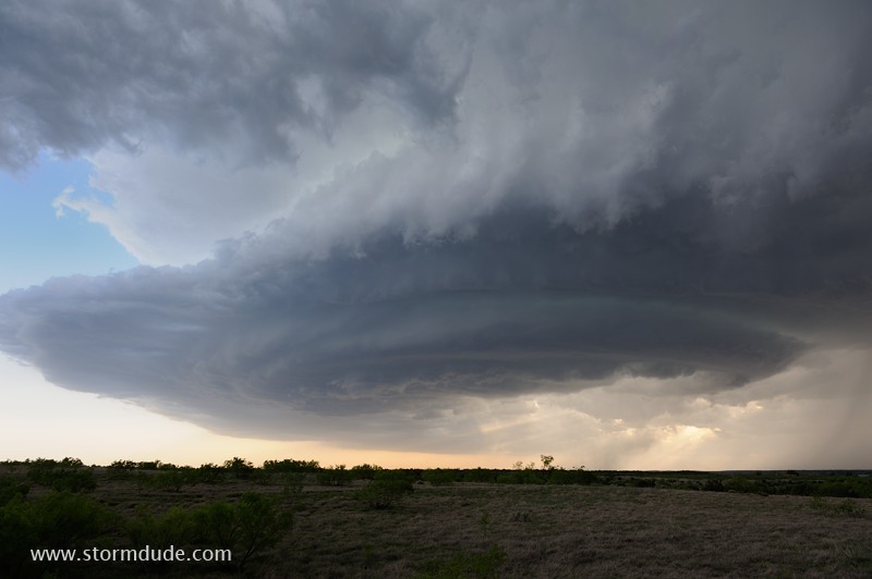
Storm takes on a classic "Mothership" appearance (April 28).
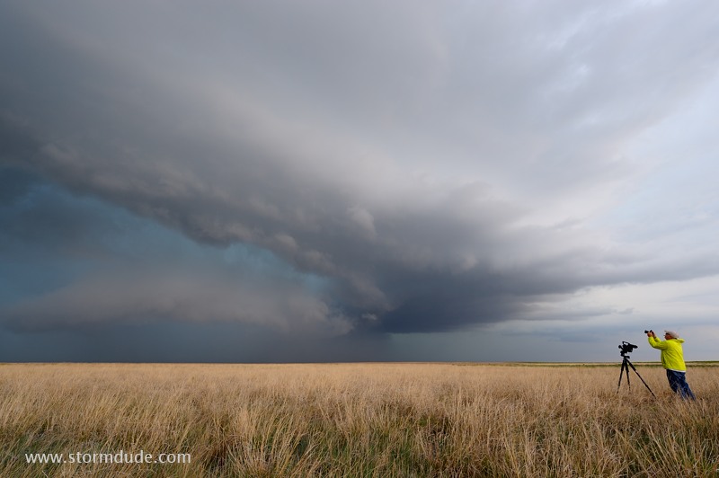
Storm chaser gets both video and a still shot of this beautiful Texas Panhandle thunderstorm (May 16).
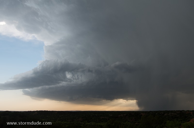
Storm in far southwest Texas (May 17).
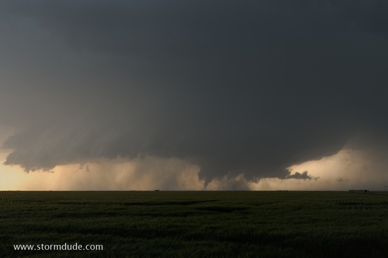
Wall cloud and tornado underneath a supercell updraft in western Kansas (May 21).
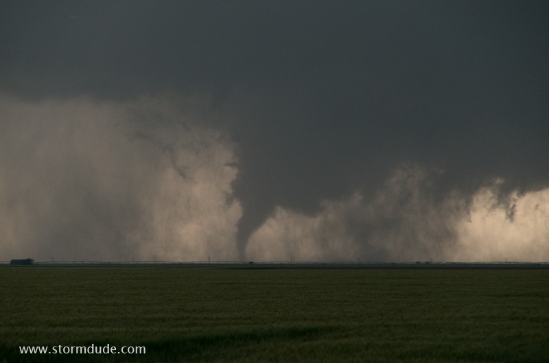
Evening tornado over a wheat field (May 21).
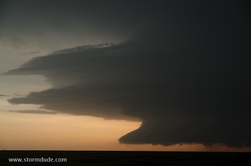
Supercell after sunset (May 21).
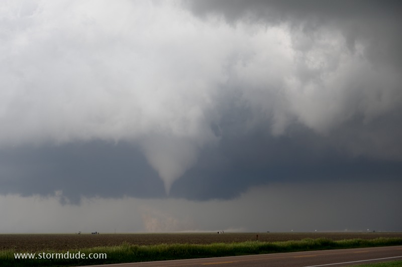
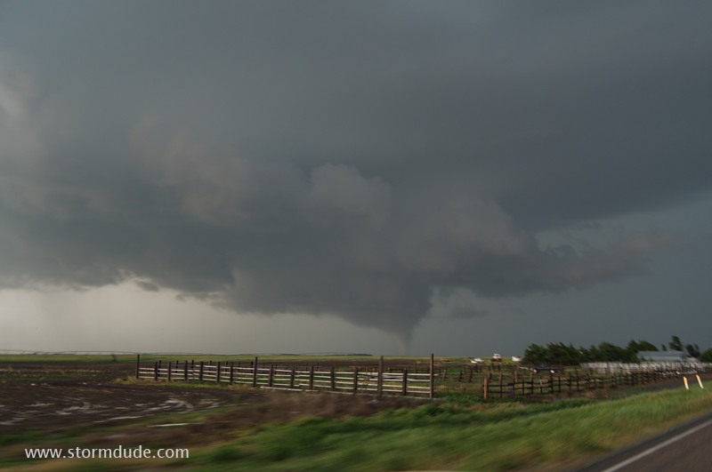
Tornado forms over a ranch south of Perryton, Texas (May 22).
It is moving across rain-soaked fields.(May 22).
Backside of severe storm at sunset in the Texas Panhandle (May 23).
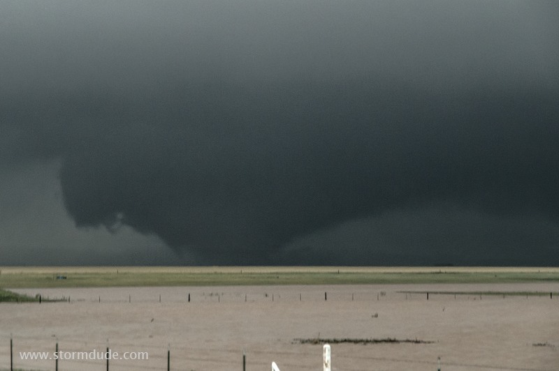
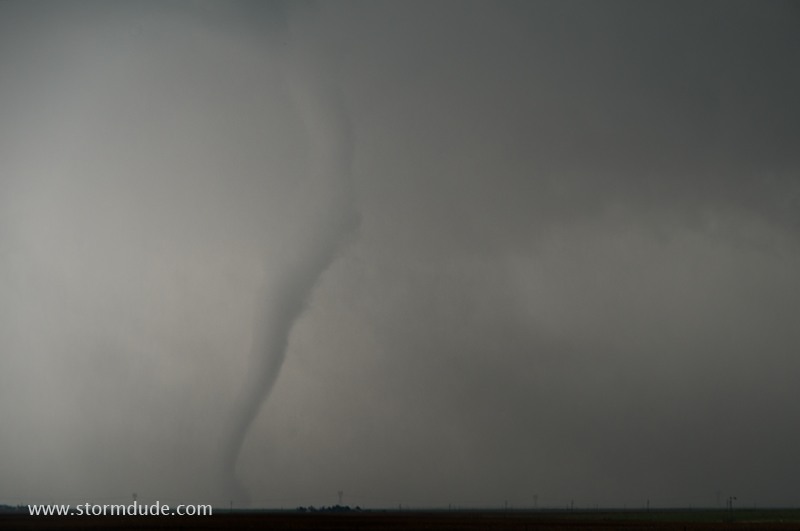
Tornado touches down northeast of Scott City, Kansas (May 24).
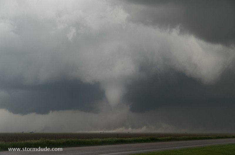
White cone tornado over a dirt field (May 24).
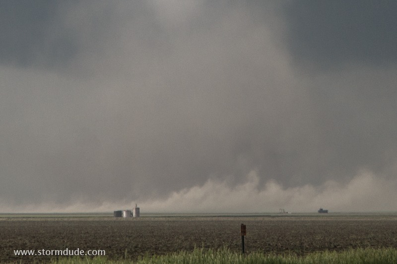
Zoomed-in view shows what it's like to be one field over from a tornado (May 24).
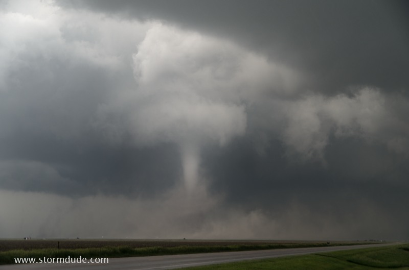
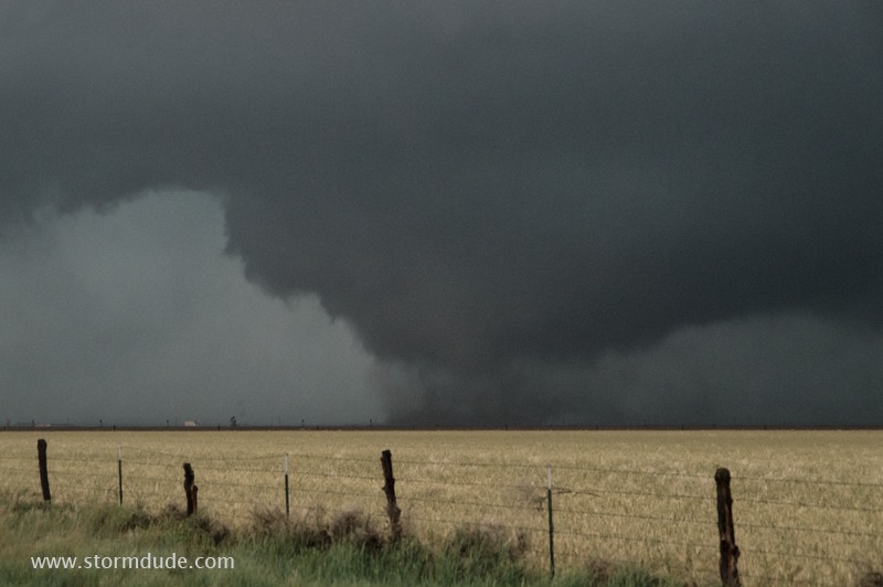
Drill-bit tornado (May 24).
An hour later, driving into a tornadic thunderstorm near Dodge City, Kansas. The tornadoes are moving away from me, so I'm in a safe position as I approach (May 24).
Under that ragged wall cloud are two tornadoes (May 24).
Ghostly tornado snakes out from the thunderstorm (May 24).
Driving towards another tornado under the same supercell (May 24).
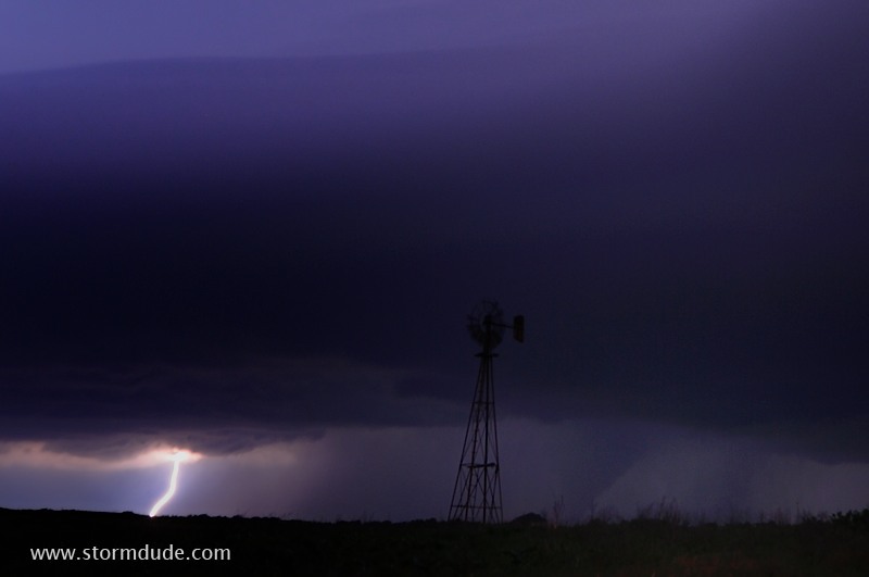
Supercell and tornado (just right of windmill) after dark near Enid, Oklahoma (May 25).
Zoomed-in view (May 25).
The next day brings another supercell, this time in southwest Kansas (May 26).
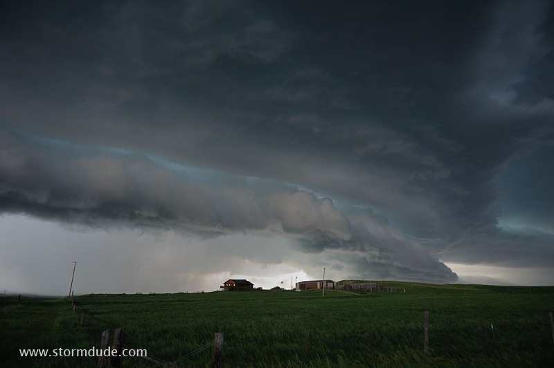
Wall cloud approaches Greensburg, Kansas. Fortunately, the storm soon weakens (May 26).
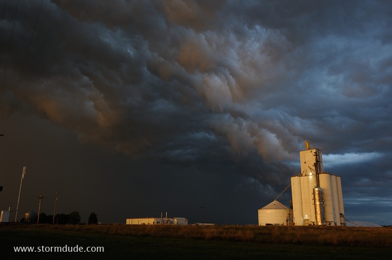
Behind the storm at dusk (May 26).
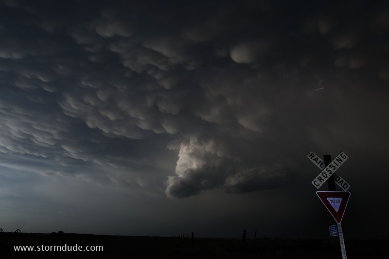
Mammatus after sunset (May 26).
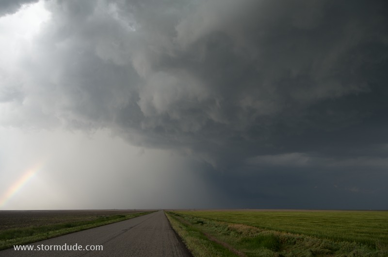
Thundershower along the front range of Colorado (June 6).
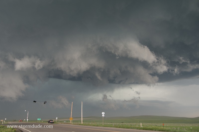
High Plains thunderstorm north of Cheyenne (June 7).
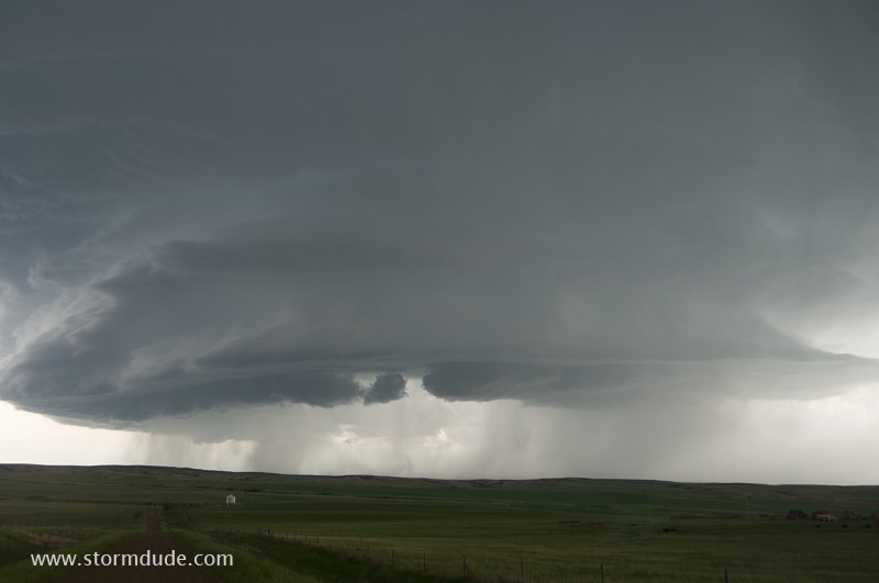
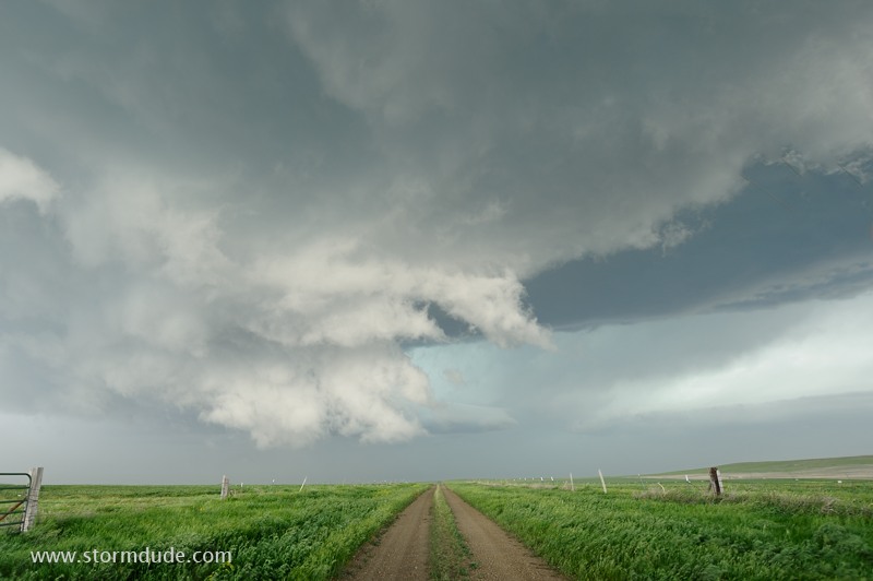
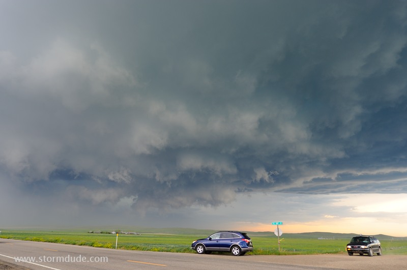
Developing storm over ranchland in central Montana (June 9).
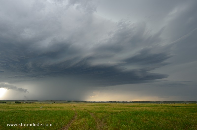
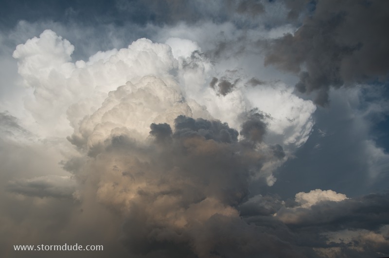
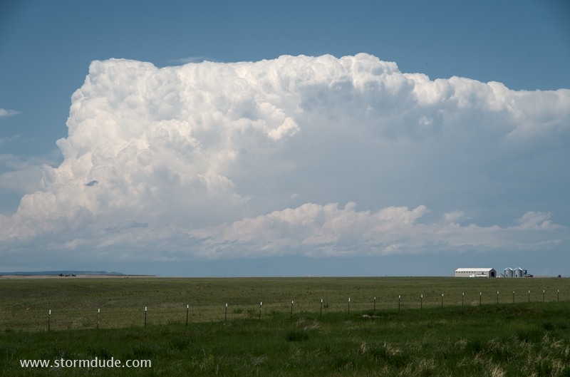
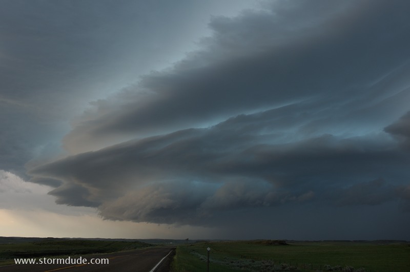
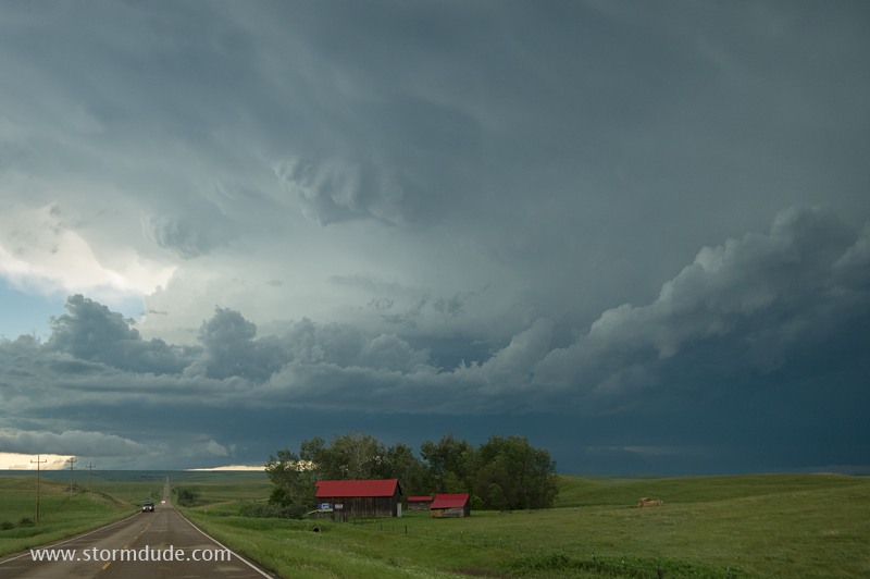
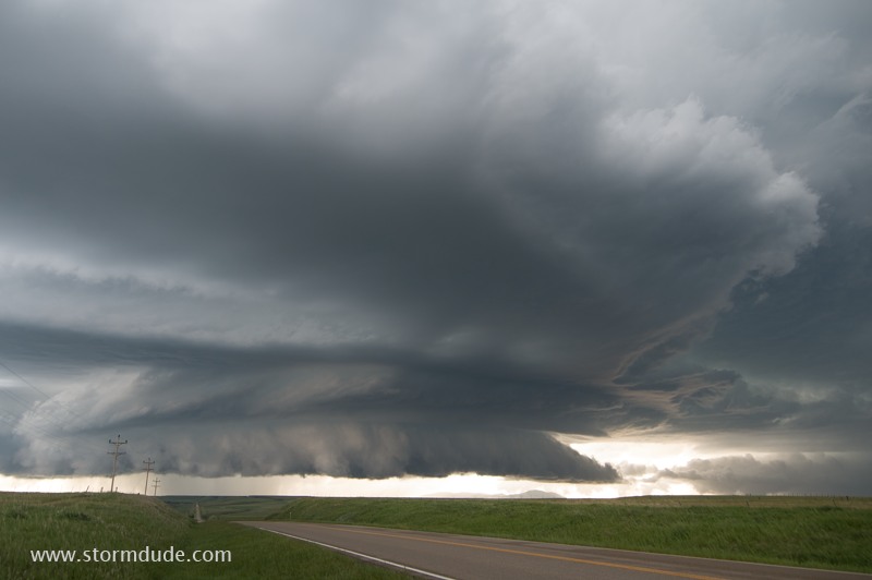
Sculpted structure of a High Plains supercell (June 9).
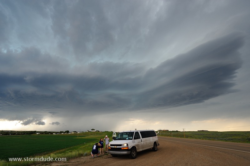
Storm chase tourists enjoy a storm as it passes near Jordan, Montana (June 9).
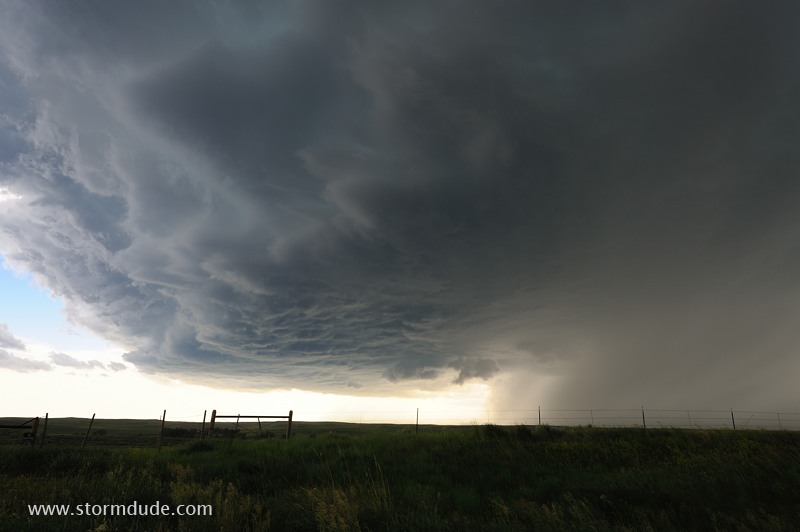
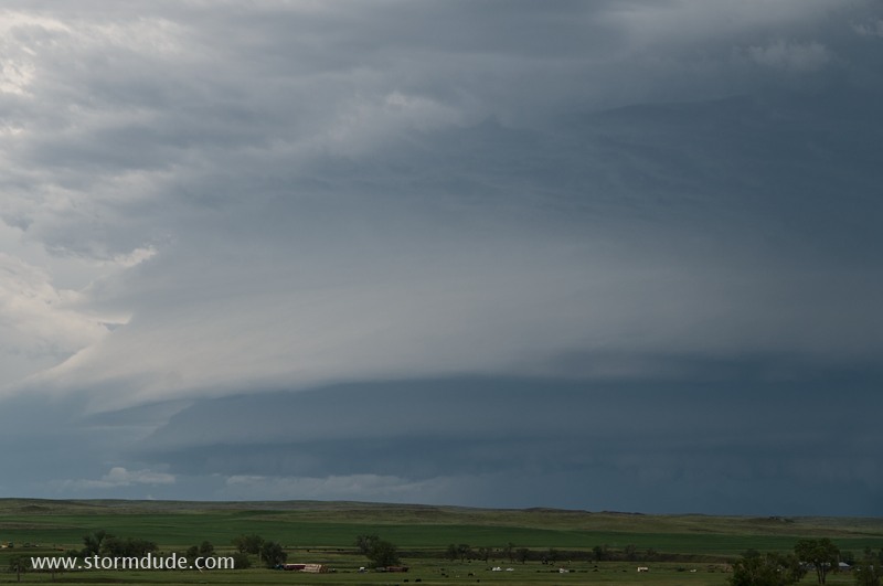
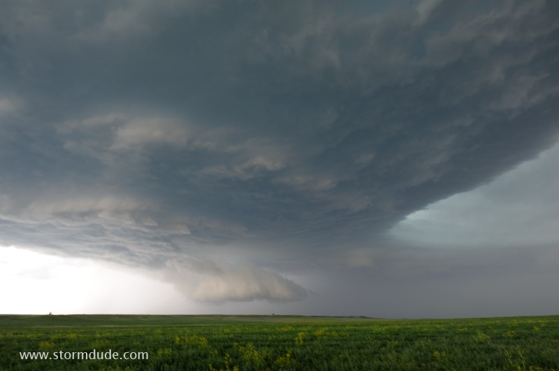
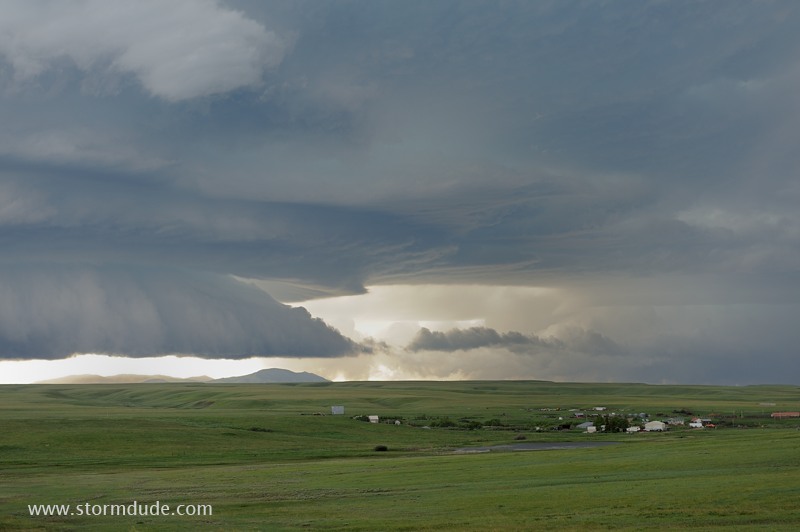
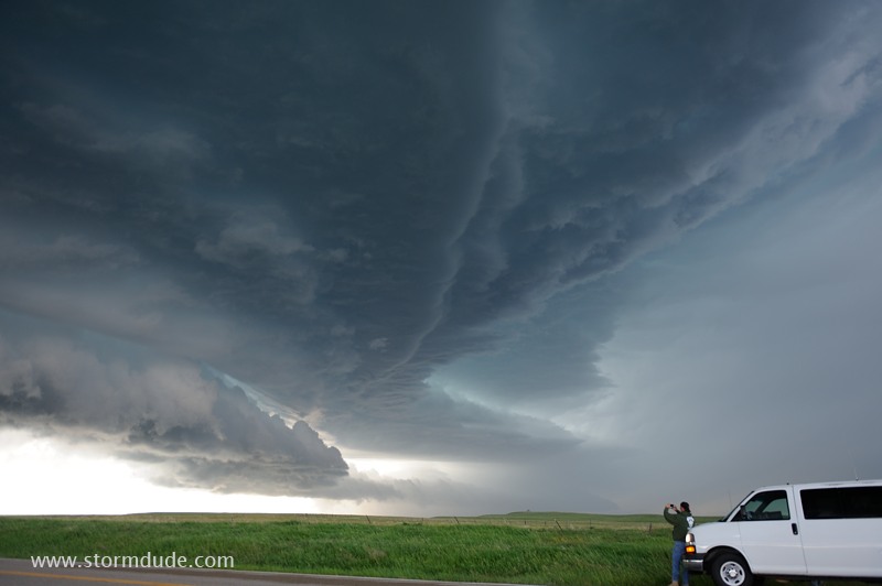
Updraft region at the leading edge of a high-based supercell (June 9).
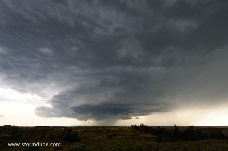
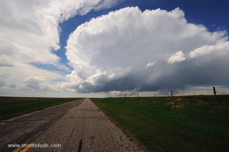
Wide-angle lens shows the entire storm (June 9).
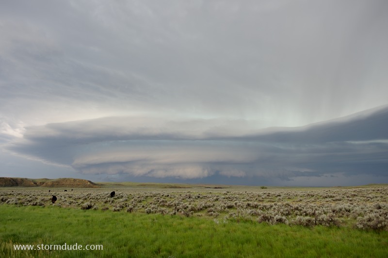
Beautiful supercell over a central Montana cattle ranch (June 9).
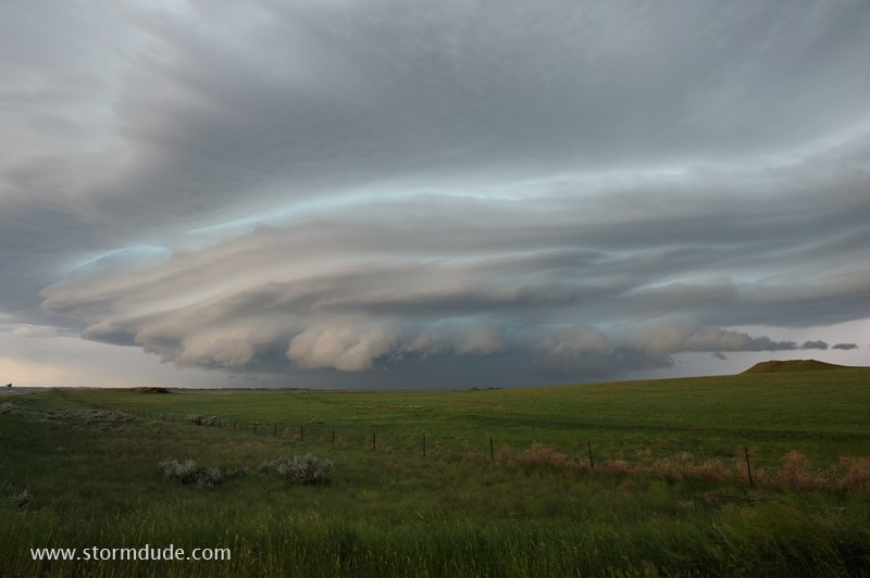
Laminar appearance of another Montana supercell (June 9).
Reflected sunlight gives the storm a surreal appearance (June 9).
The storm constantly changes shape as it races southeast (June 9).
Storm drops golfball-size hail as it crosses the highway (June 9).
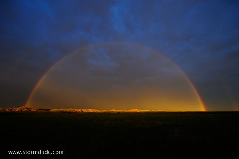
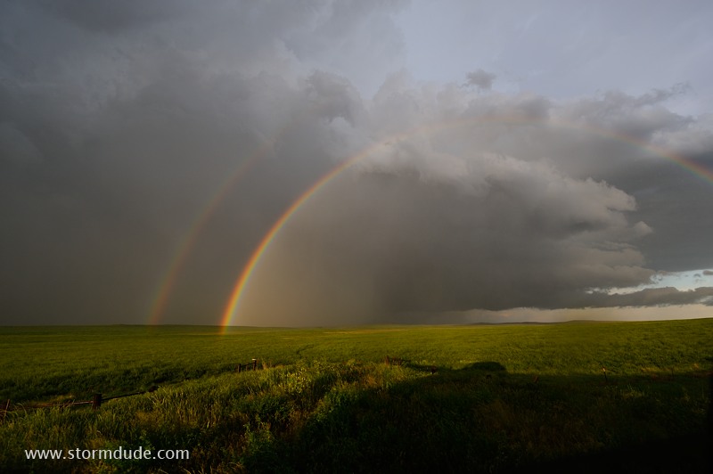
Double rainbow at the rear of the storm (June 9).
Another central Montana supercell (June 10).
Ragged clouds are associated with a powerful RFD (June 10).
Rear-flank downdraft sweeps forward with 50 mph winds (June 10).
Storm chasers wait out the wind storm (June 10).
New supercell develops back to the west (June 10).
North end of storm over a Montana cattle ranch (June 10).
Large hail is the only threat from this outflow-dominated storm (June 10).
Storm chaser enjoys the dramatic clouds (June 10).
Too bad we don't get thunderstorms like this in Southern California (June 10).
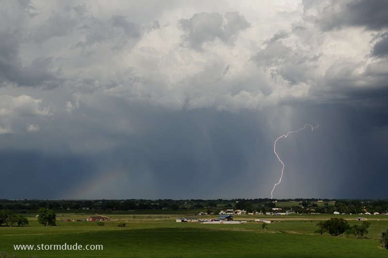
After the storm has passed, a double rainbow appears over a wheat field (June 10).
Later that evening, I watch the last storm of the season. A very good year during which I avoided chase crowds and still saw many supercells and tornadoes.