April 25: Western Oklahoma Supercell
Storm fires up in the eastern Texas Panhandle, just northwest of Wheeler, late in the afternoon.
Another storm develops to my east, in western Oklahoma.
I stay with the Wheeler storm as it moves northeast into far western Oklahoma.
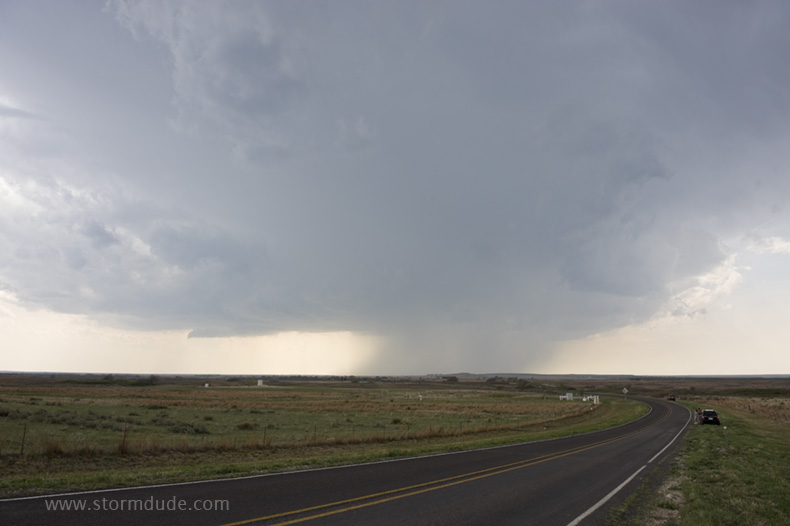
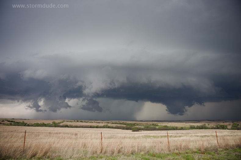
Grazing land in Black Kettle National Grassland between Cheyenne and Roll.
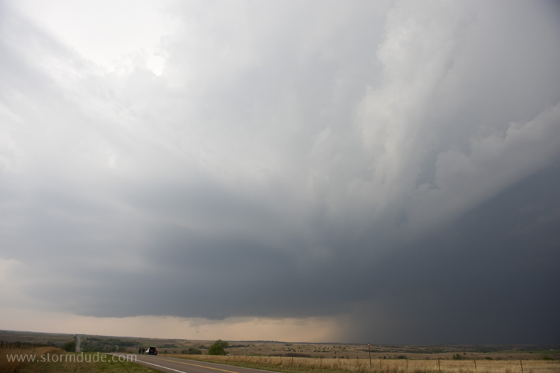
CAPE and shear are marginal as the storm tries to organize.
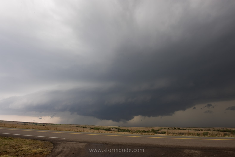
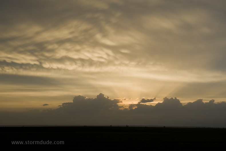
Dusk approaches as the storm nears the town of Leedey.
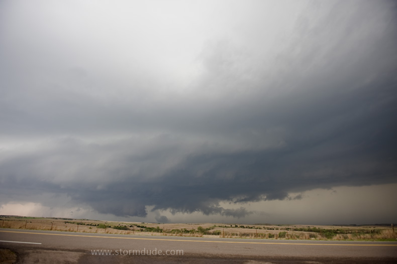
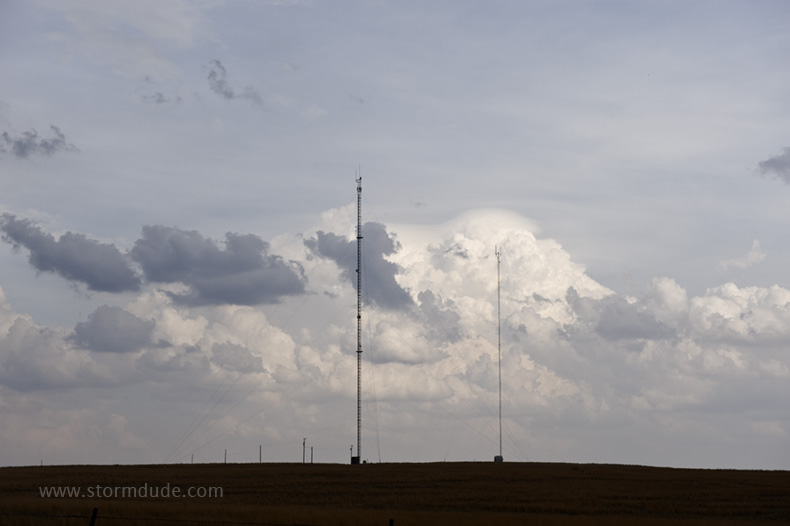
Small wall clouds form and dissipate, never displaying the rotation associated with a stronger storm.
Nevertheless, a beautiful sight.
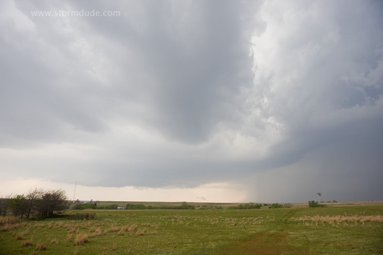
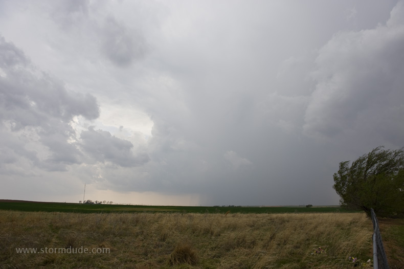
Final view before sunset.
April 26: Western Oklahoma Tornado
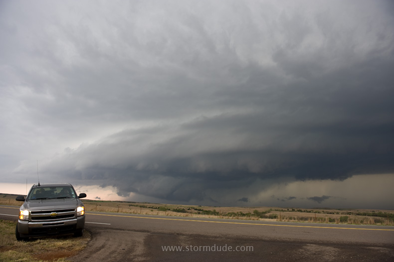
Mid-afternoon intercept, again near Wheeler, Texas. Richer moisture and better shear should result in stronger storms today.
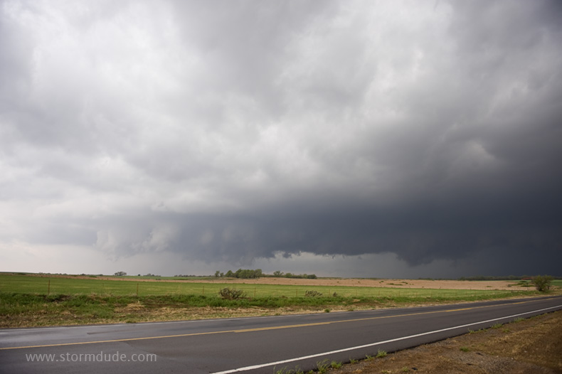
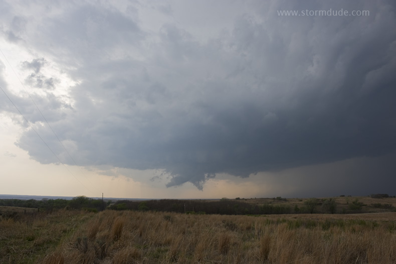
After a long drive to get ahead of the storm, I end up near Roll, Oklahoma, in great position.
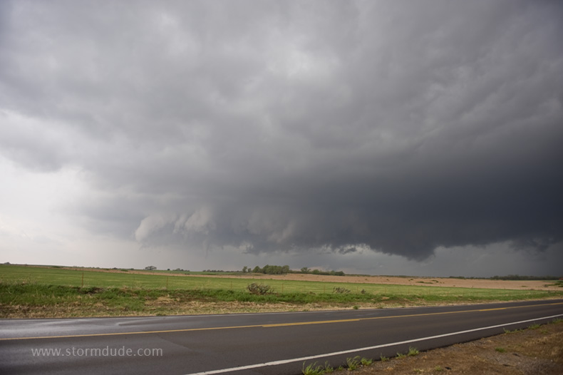
Within a few minutes after arriving, I watch a wall cloud just to my southwest produce a small grey funnel.
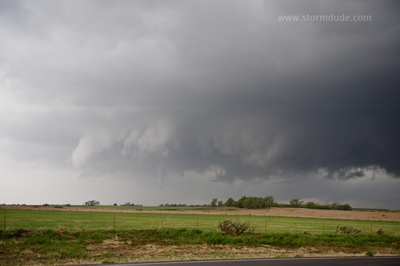
Closer view.
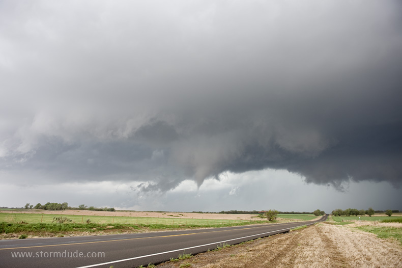
A new funnel develops just to my west.
A needle touches down.
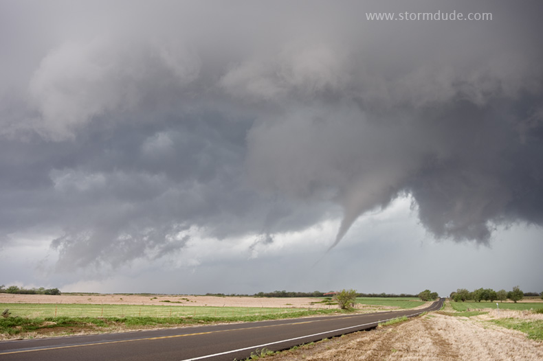
A few moments later.
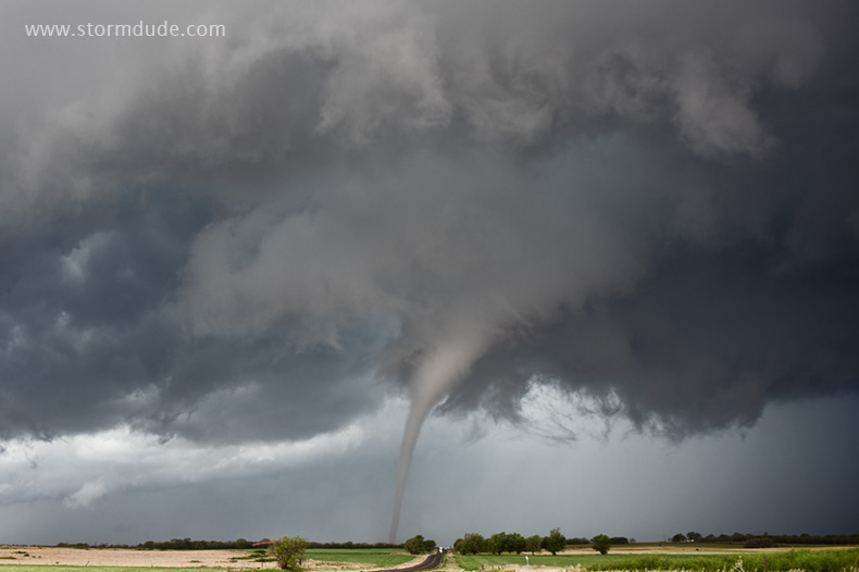
One of the best views I've ever had of a tornado.
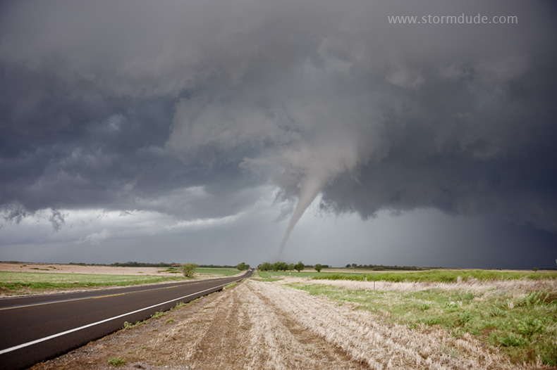
Wide angle shot.
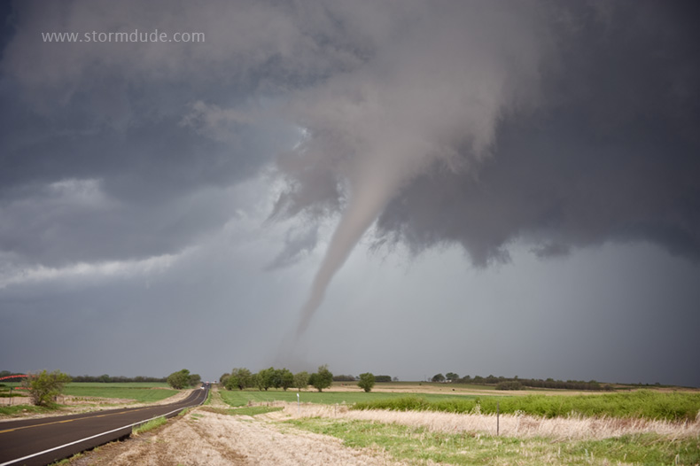
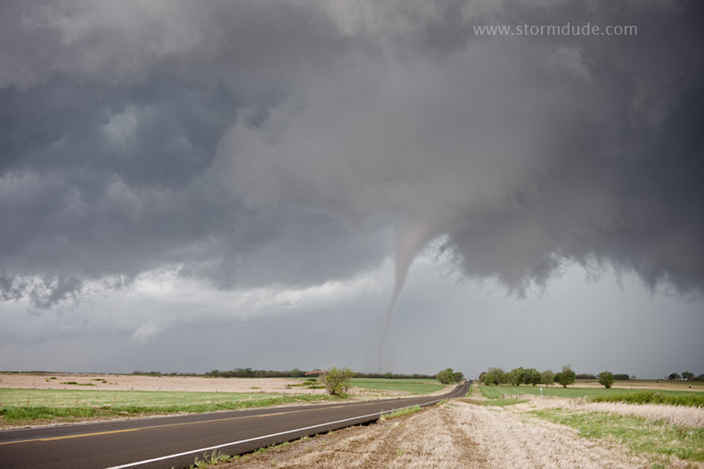
Magnificent display of nature.
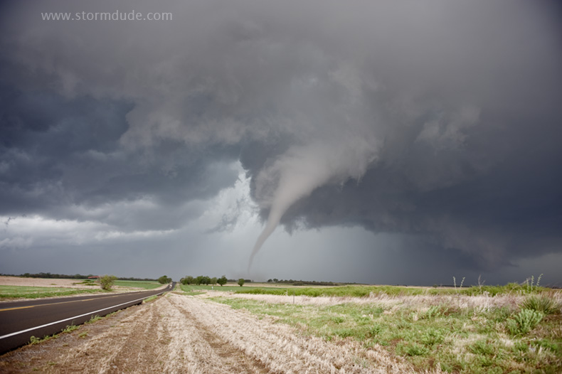
The tornado is moving quickly northeast.
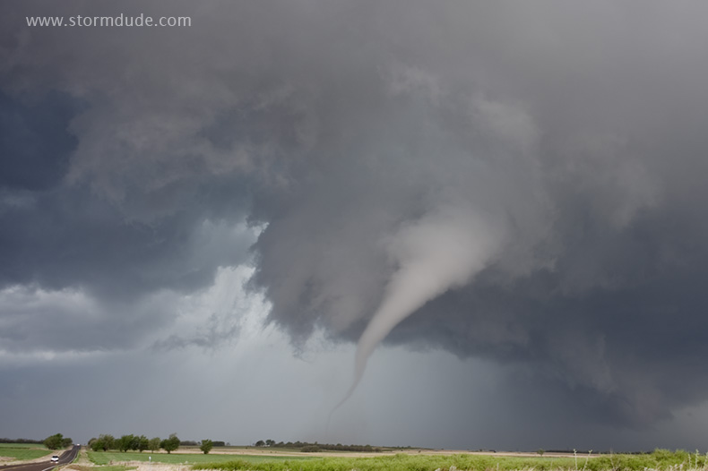
This is the type of sight I've dreamed about since the early 1980s, when I moved to Ft. Worth to find and photograph severe thunderstorms. Fourteen years after getting serious about storm chasing (in 1995 when I discovered readily accessible weather data on the Internet), a perfect view of a very scenic tornado. Persistence and patience pays!
End of a fulfilling day of chasing after a quiet beginning to the season.